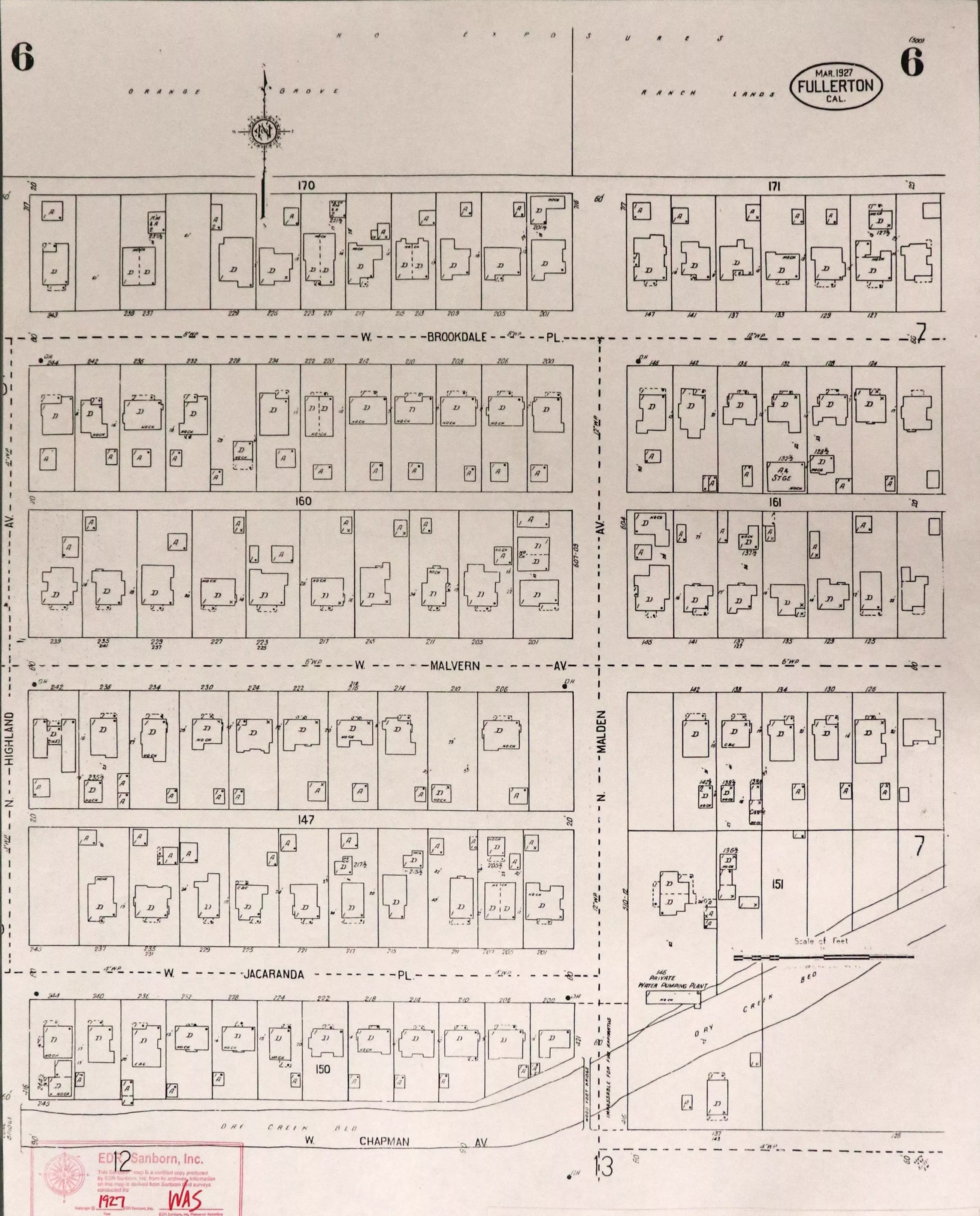
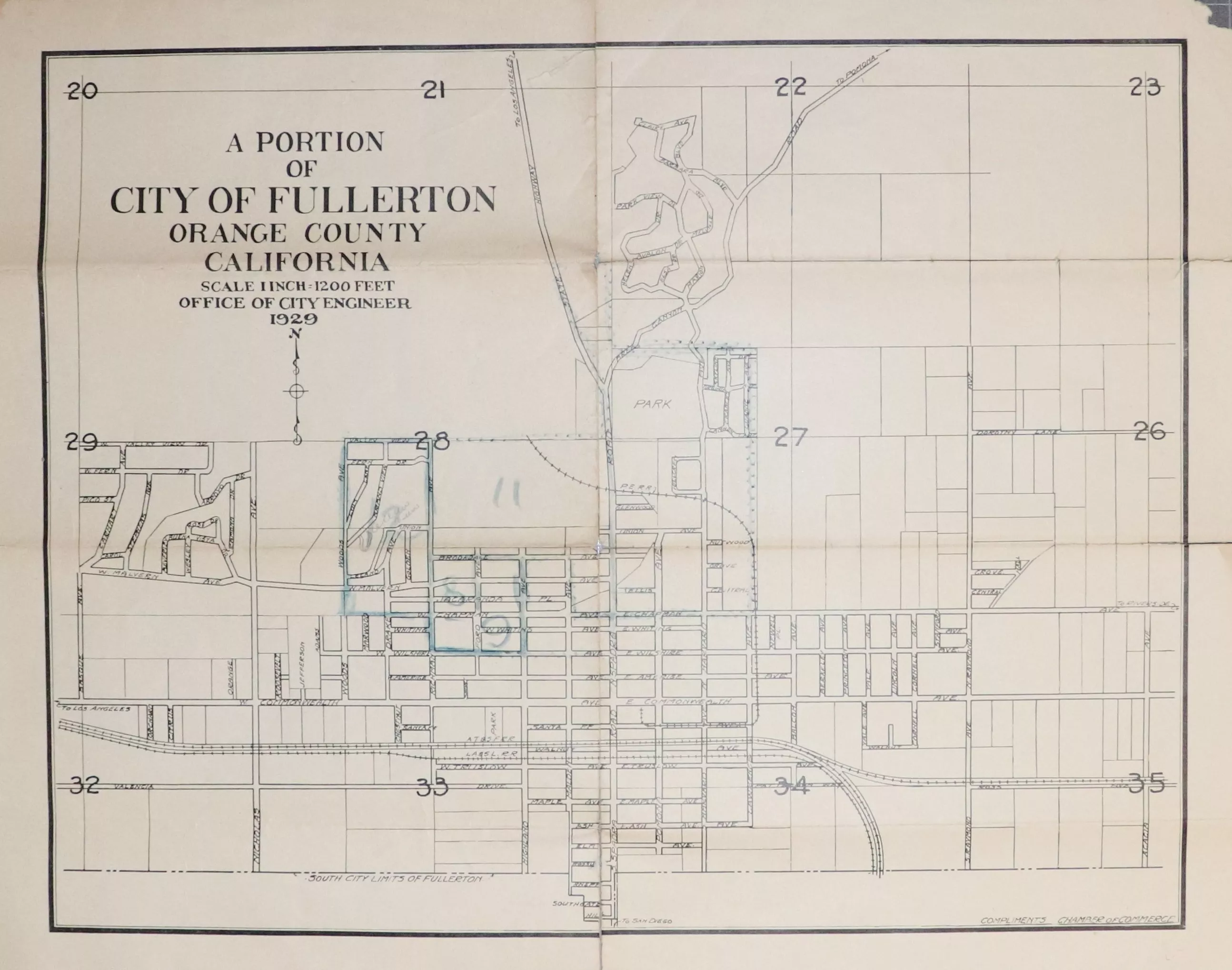
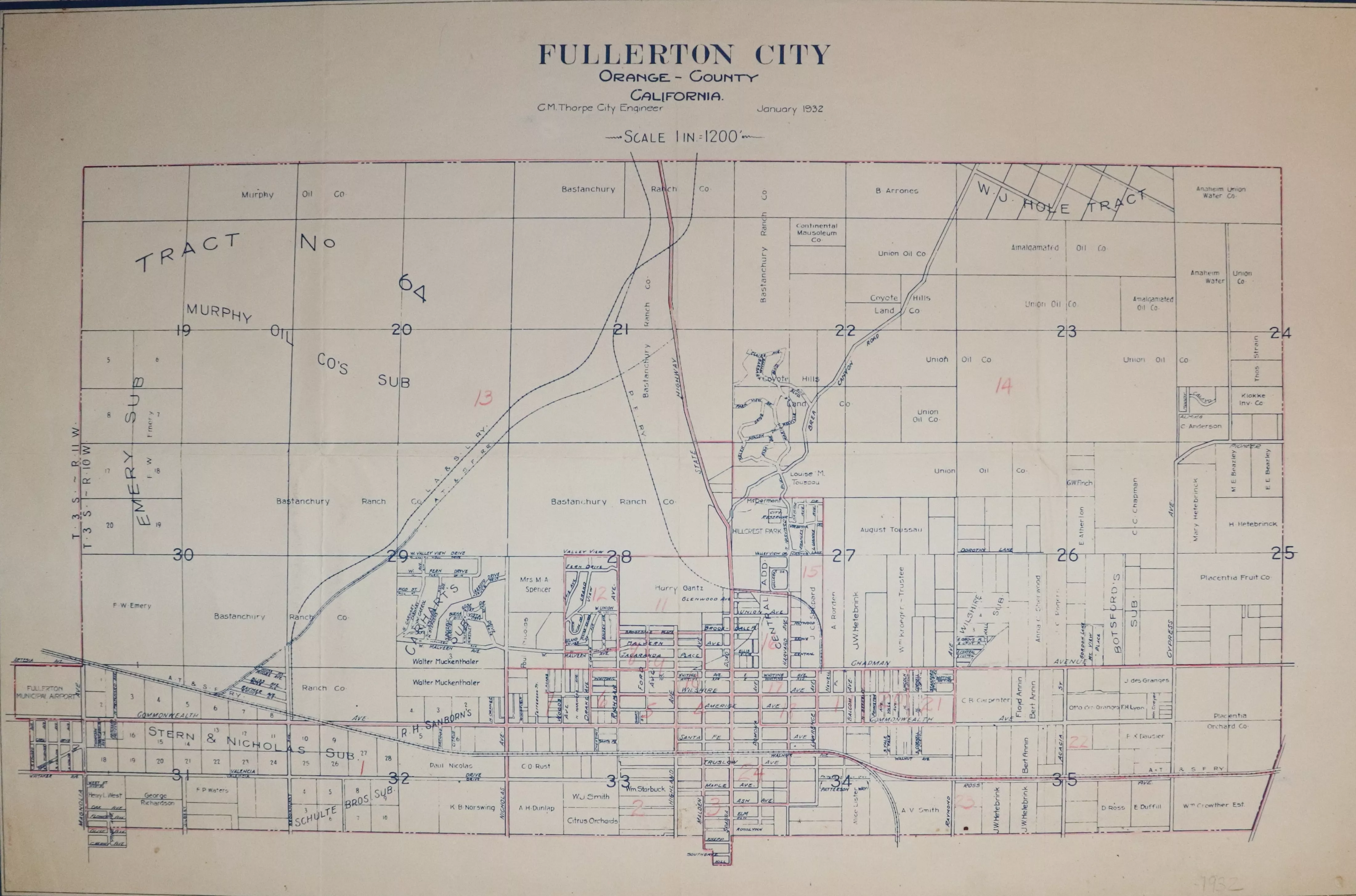
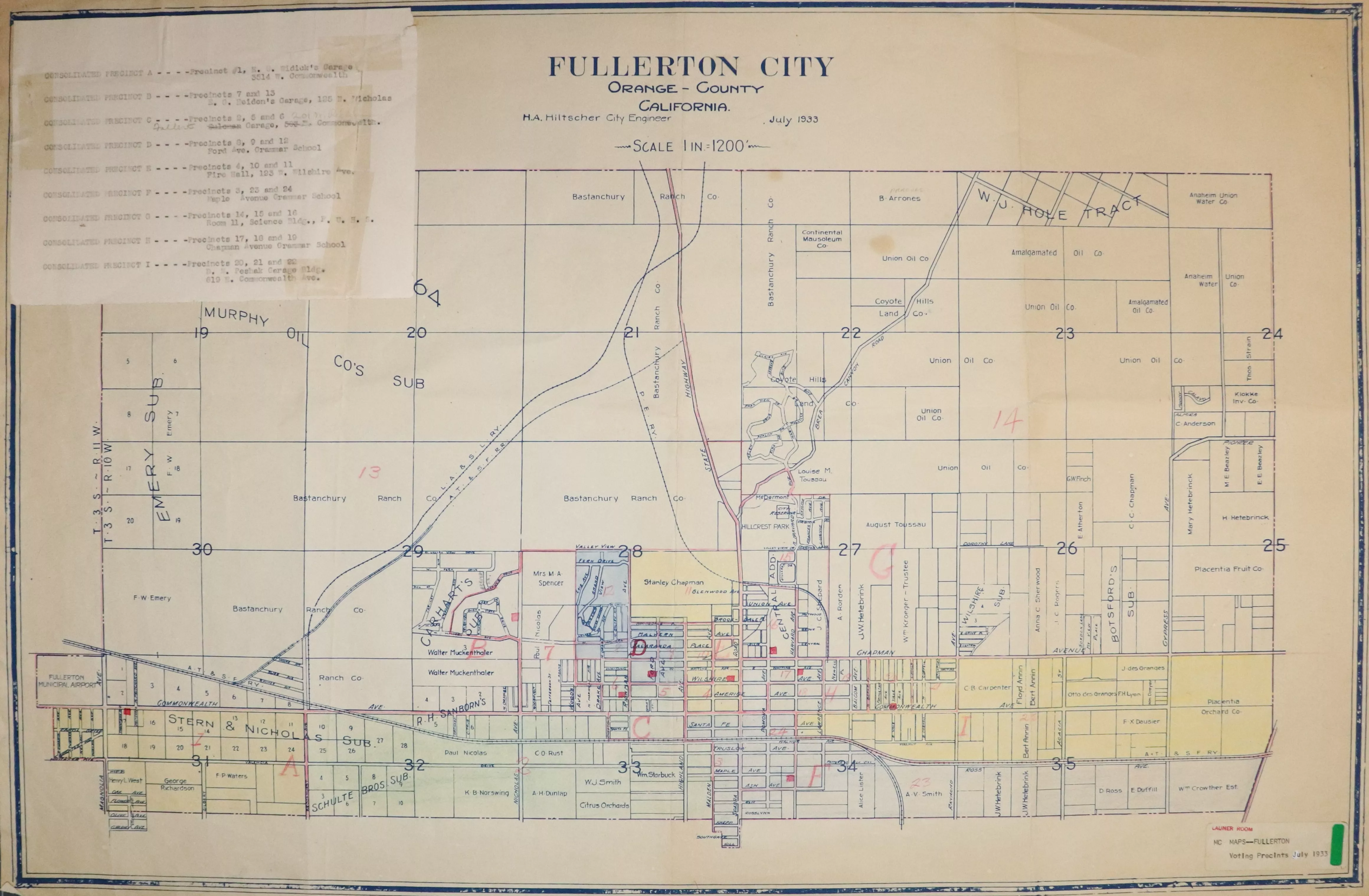
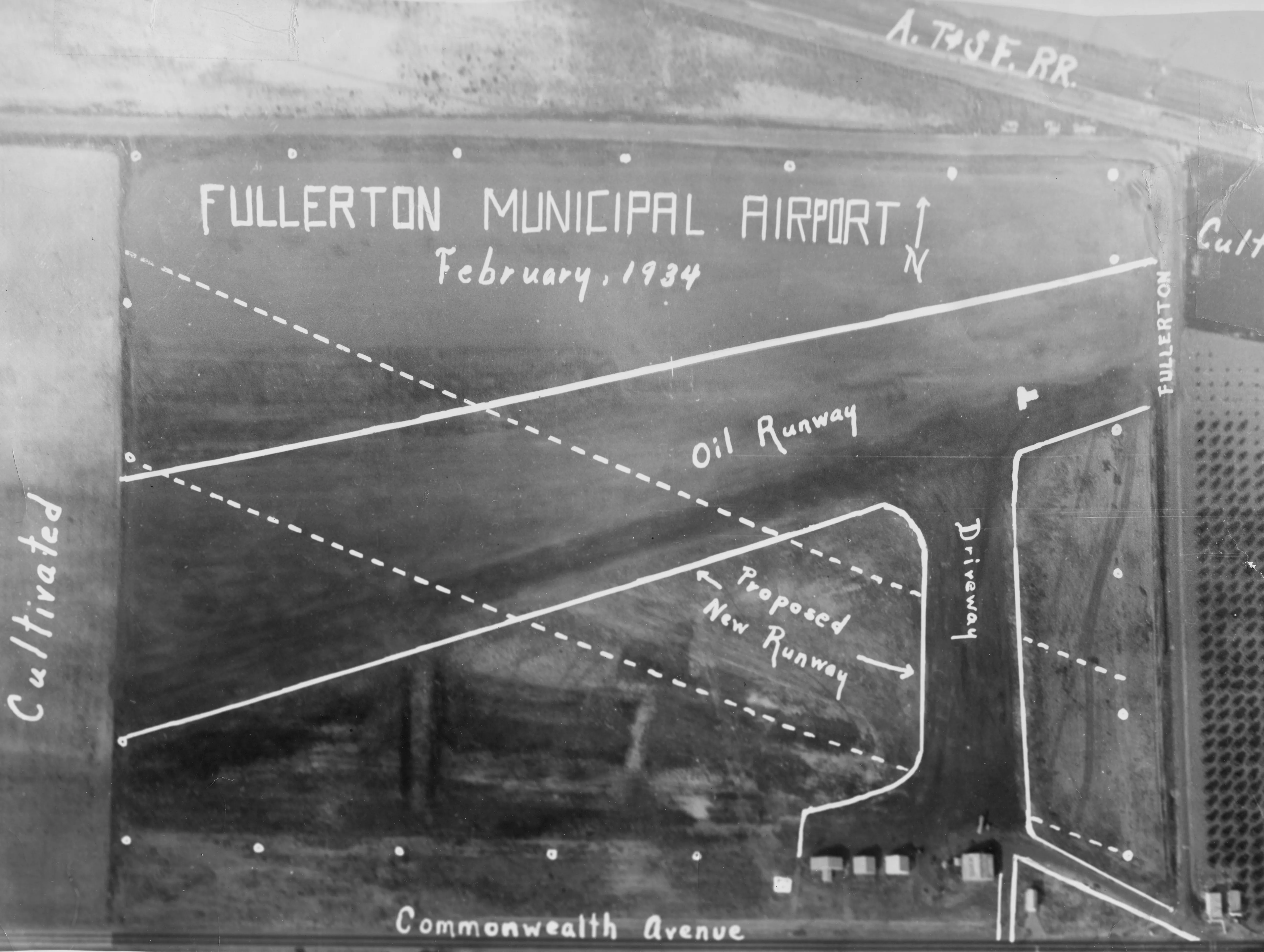
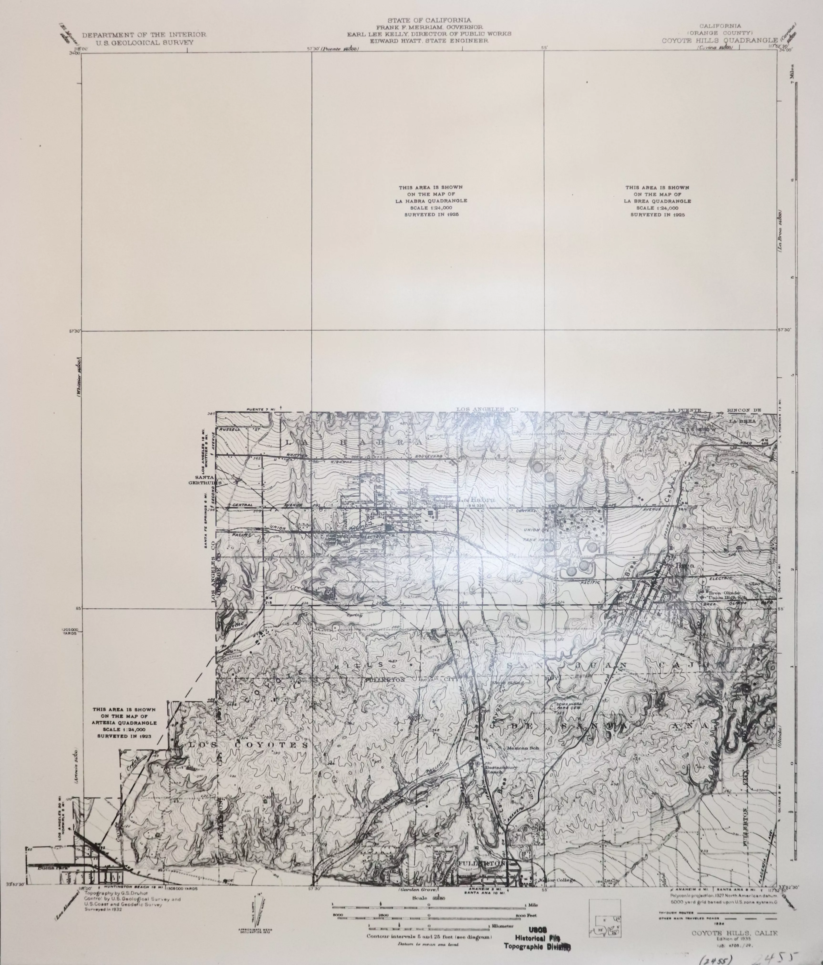
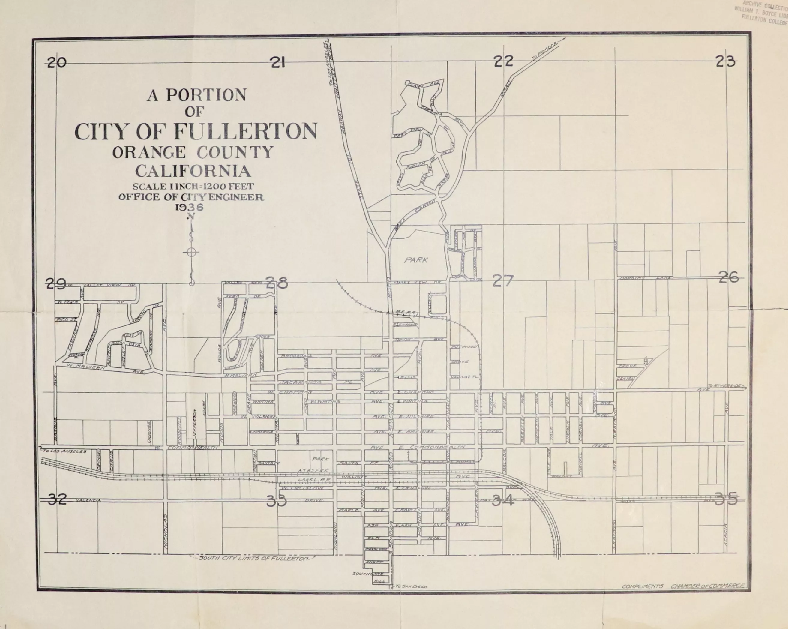
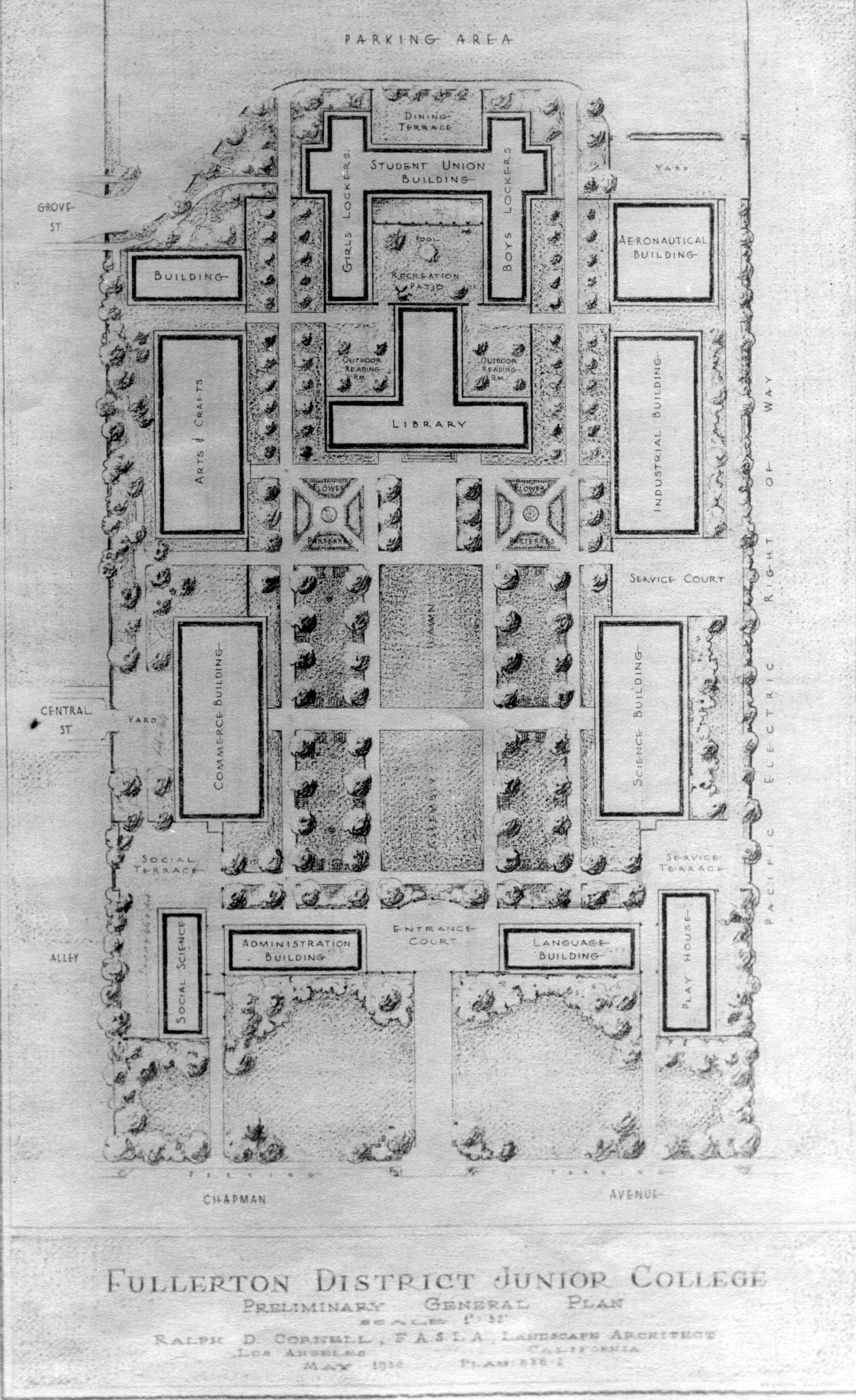
1920 | City of Fullerton Tract Map 1923 | Aerial View: Golden Hill Subdivision 1923 | Chamber of Commerce 1927 | Aerial View: FUHS Campus 1927 | Sanborn Maps Click the image above to view the full map series. 1929 | City of Fullerton Engineering Department 1932 | City of Fullerton Engineering Department 1933 | Voting Precincts 1934 | Aerial View: Airport Runway 1935 | Coyote Hills Topographic Map 1936 | City of Fullerton Engineering Department 1936 | Rendering: Fullerton College Additional maps available at the Local History Room. Check out the Local History Room to find more information!