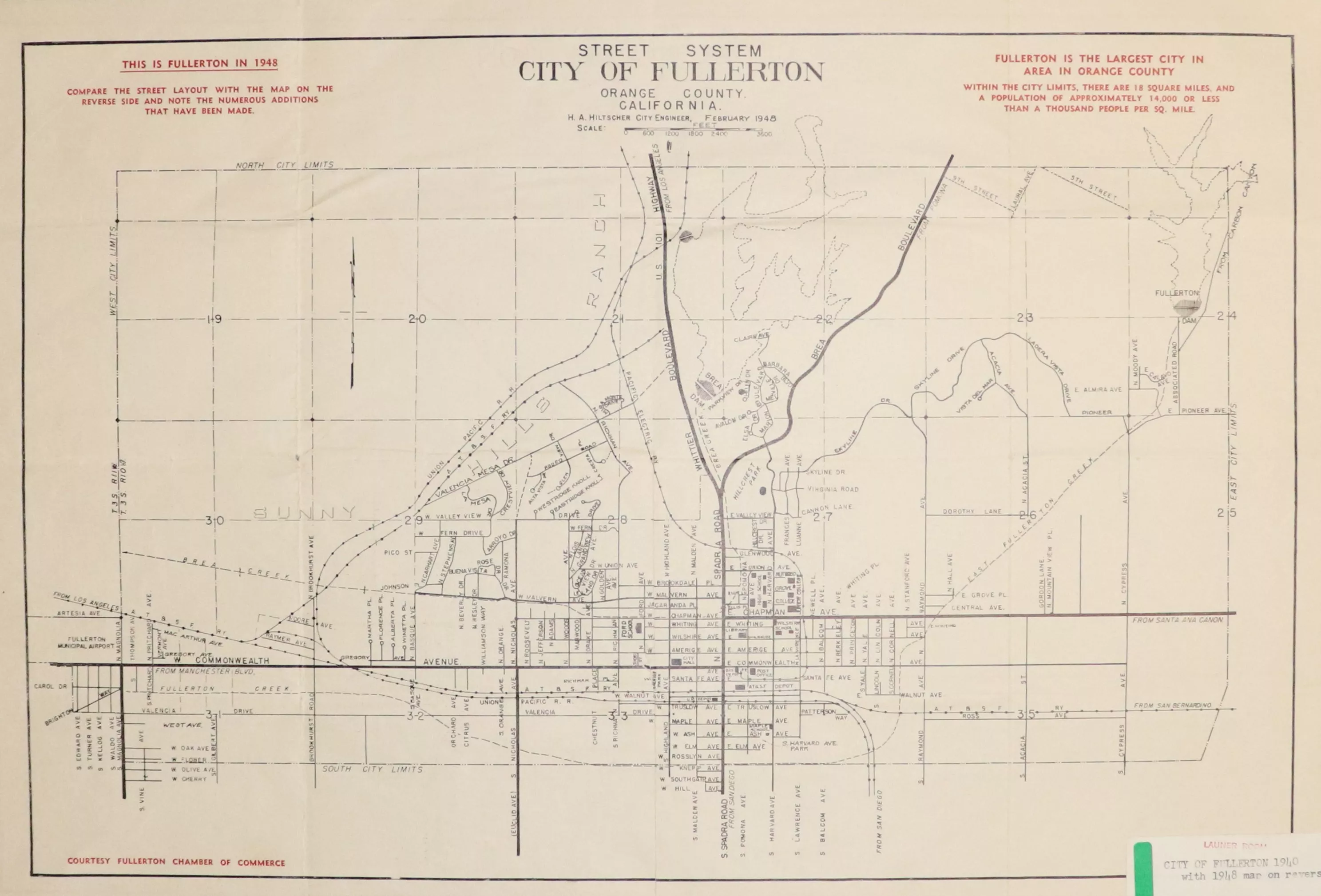
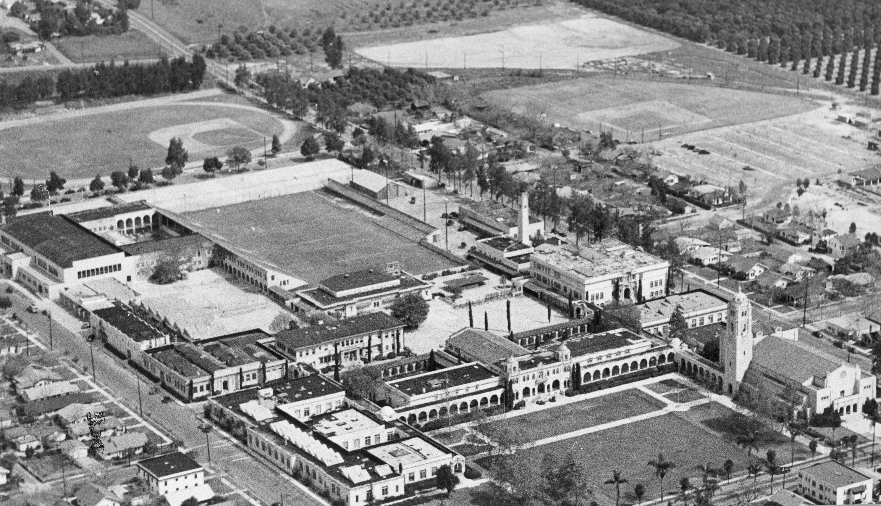
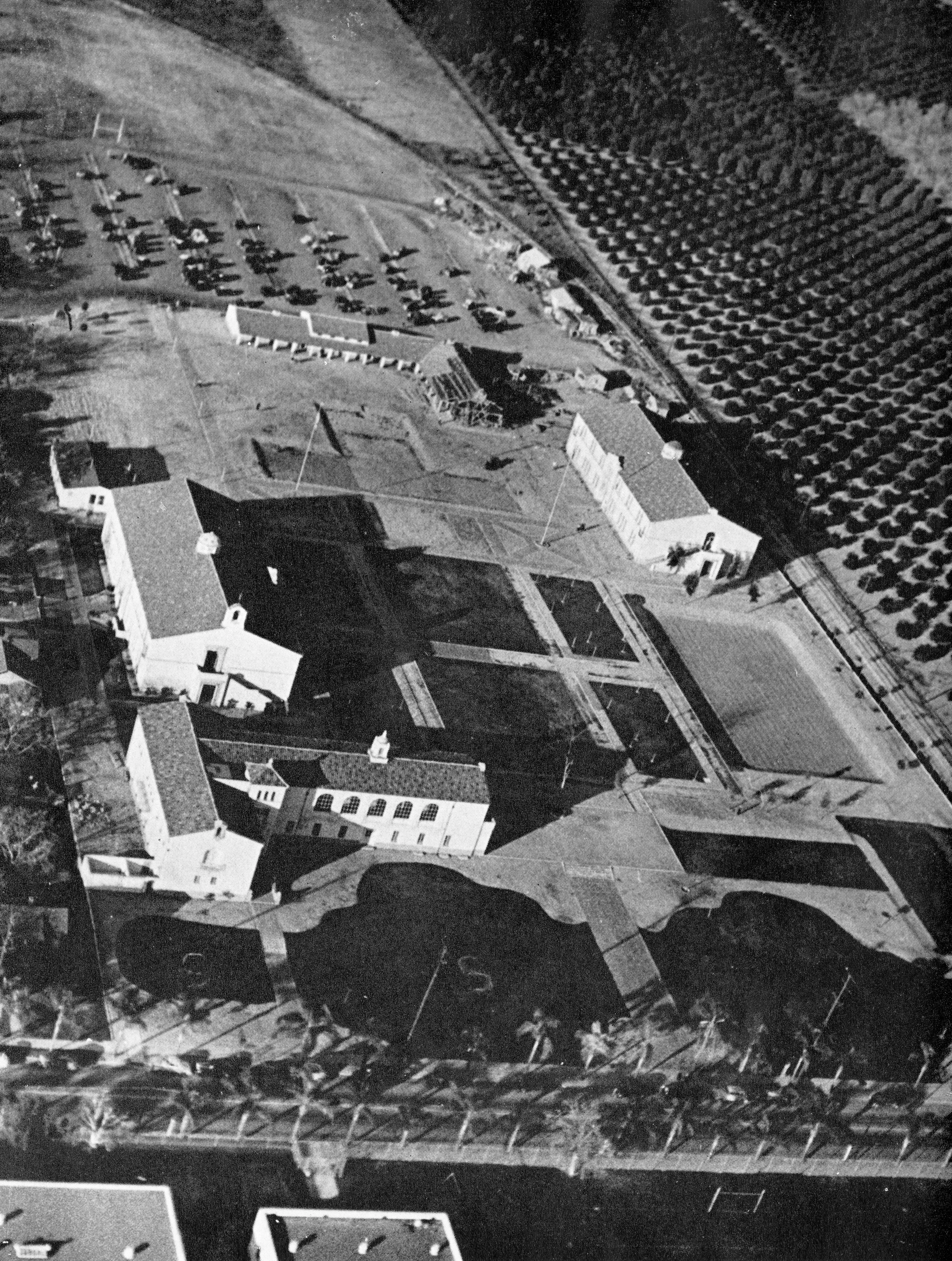
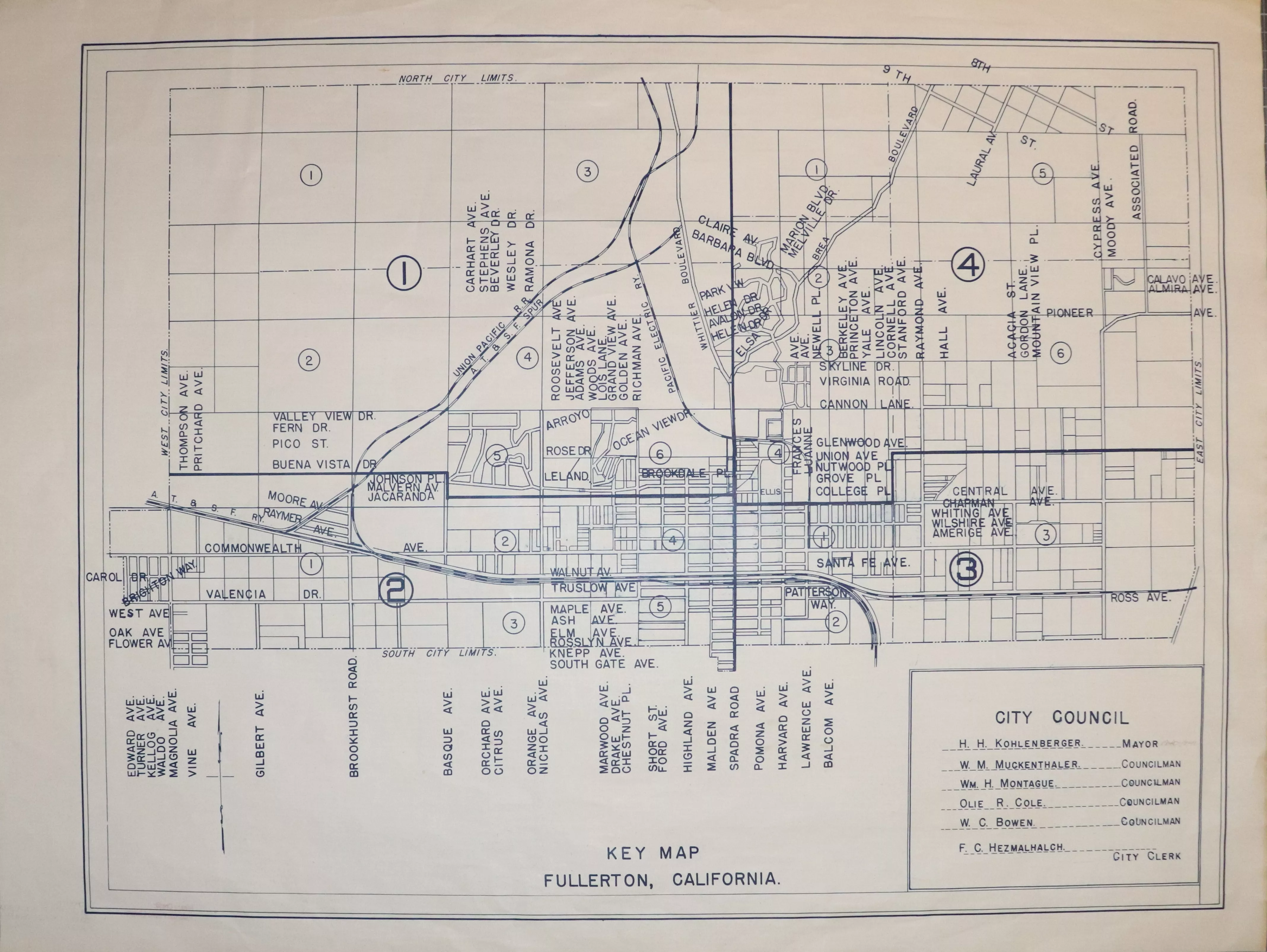
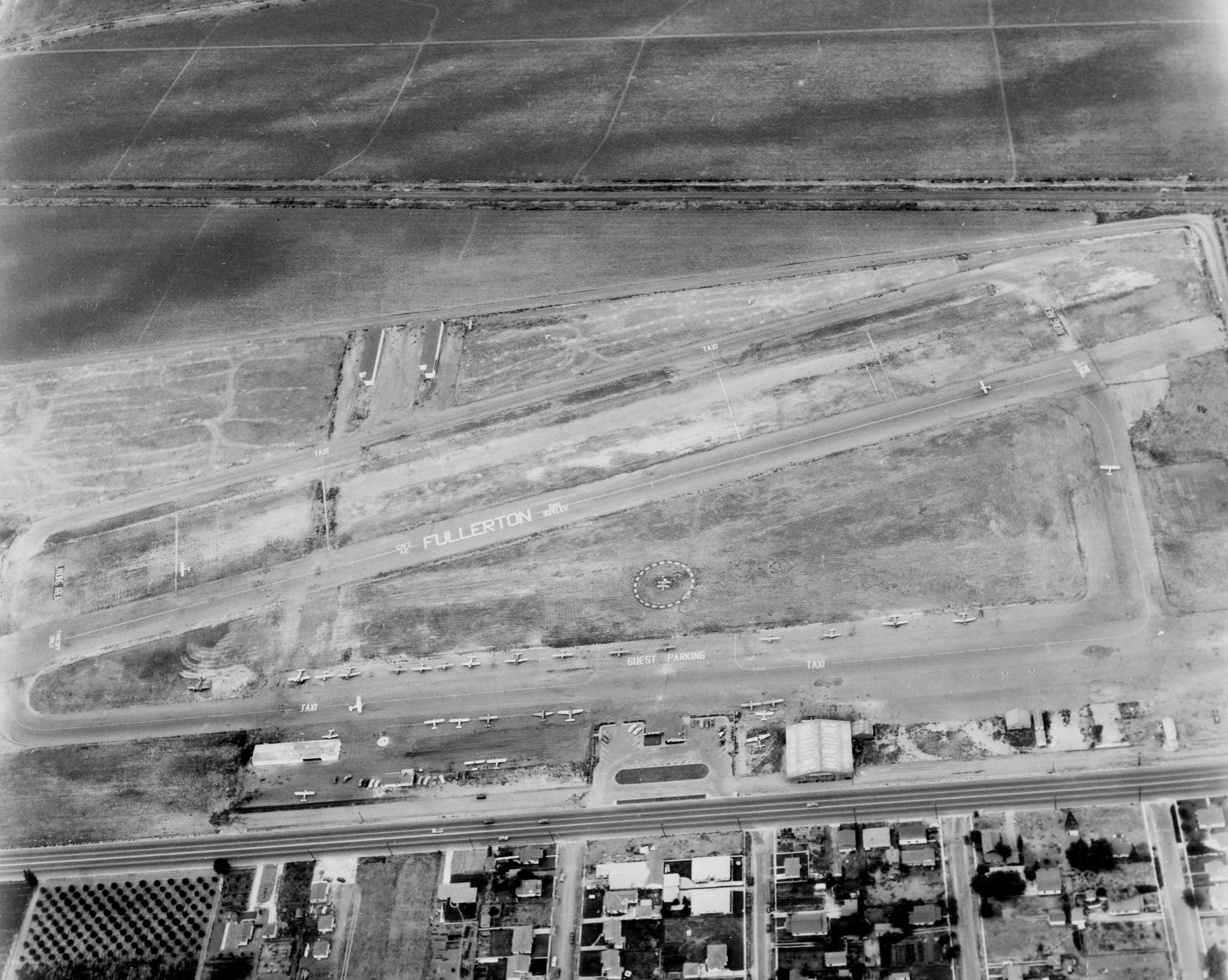
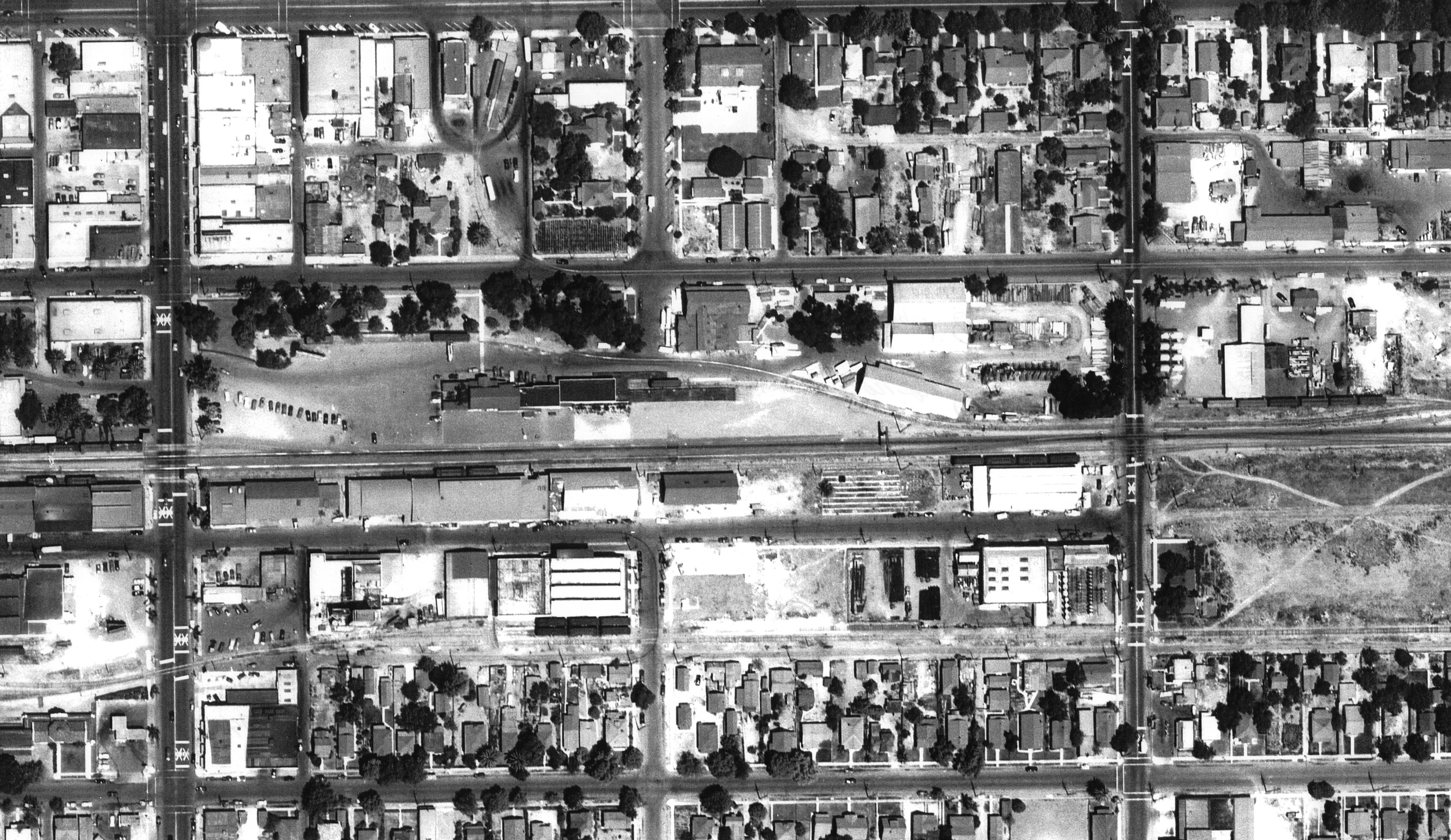
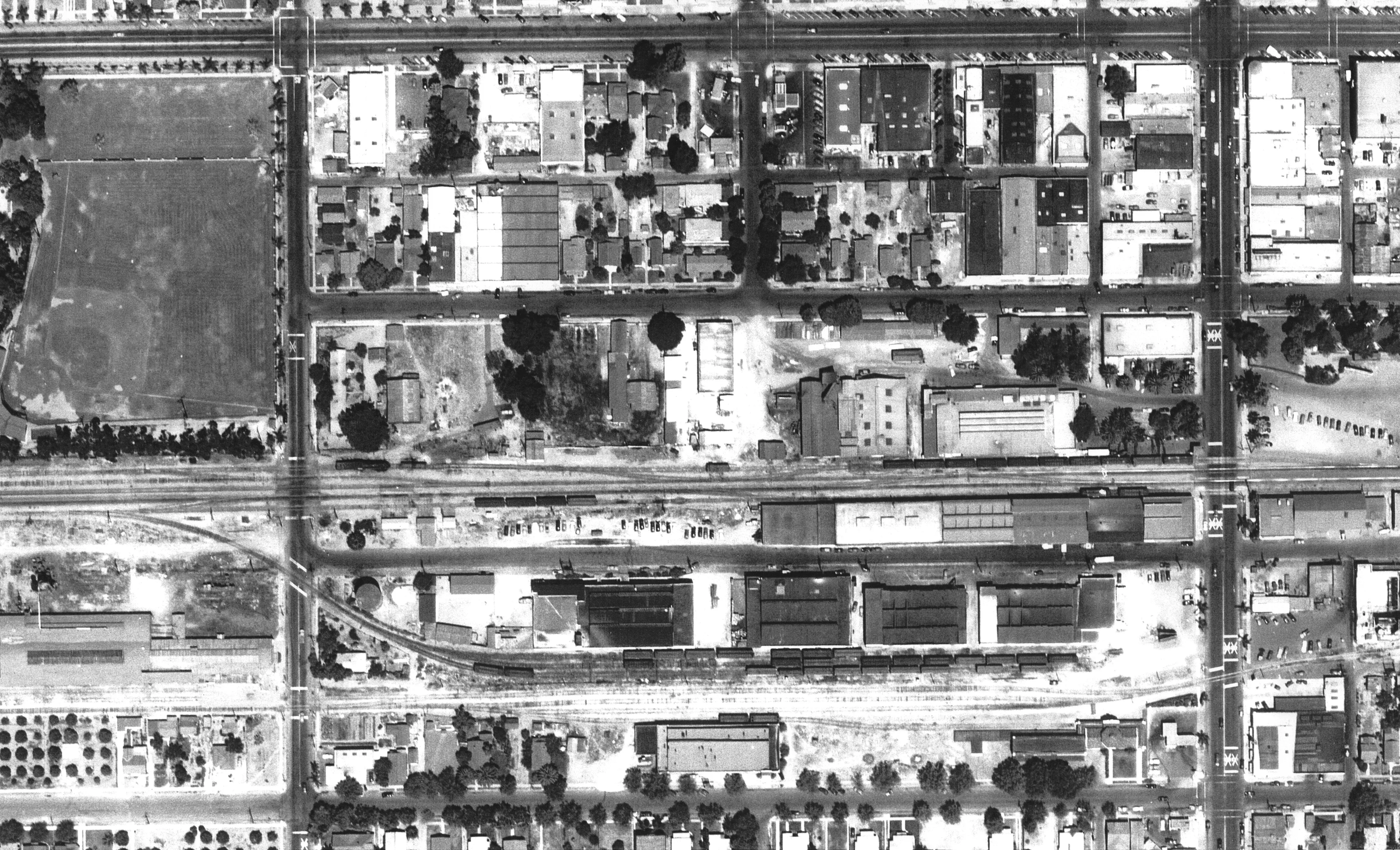
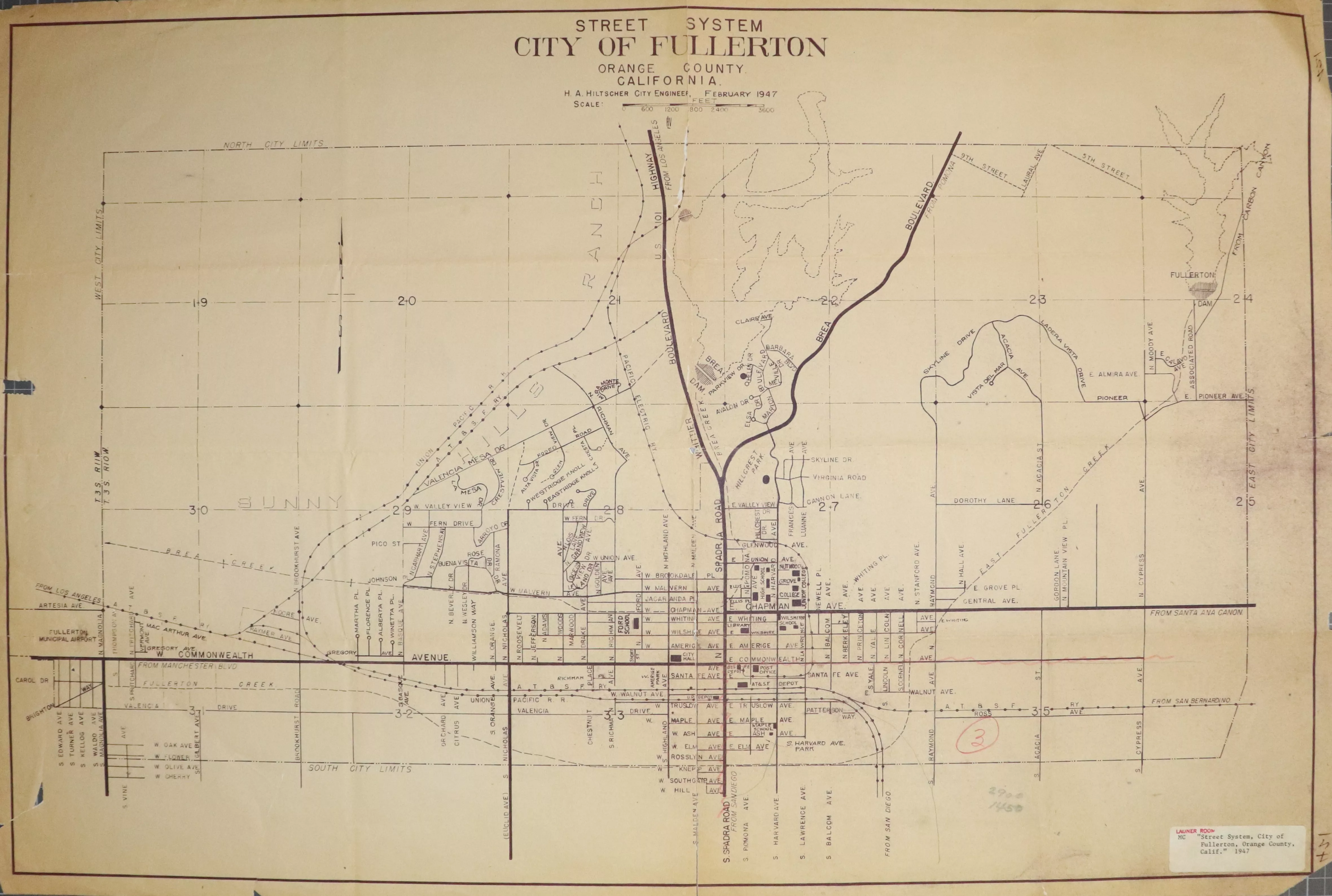
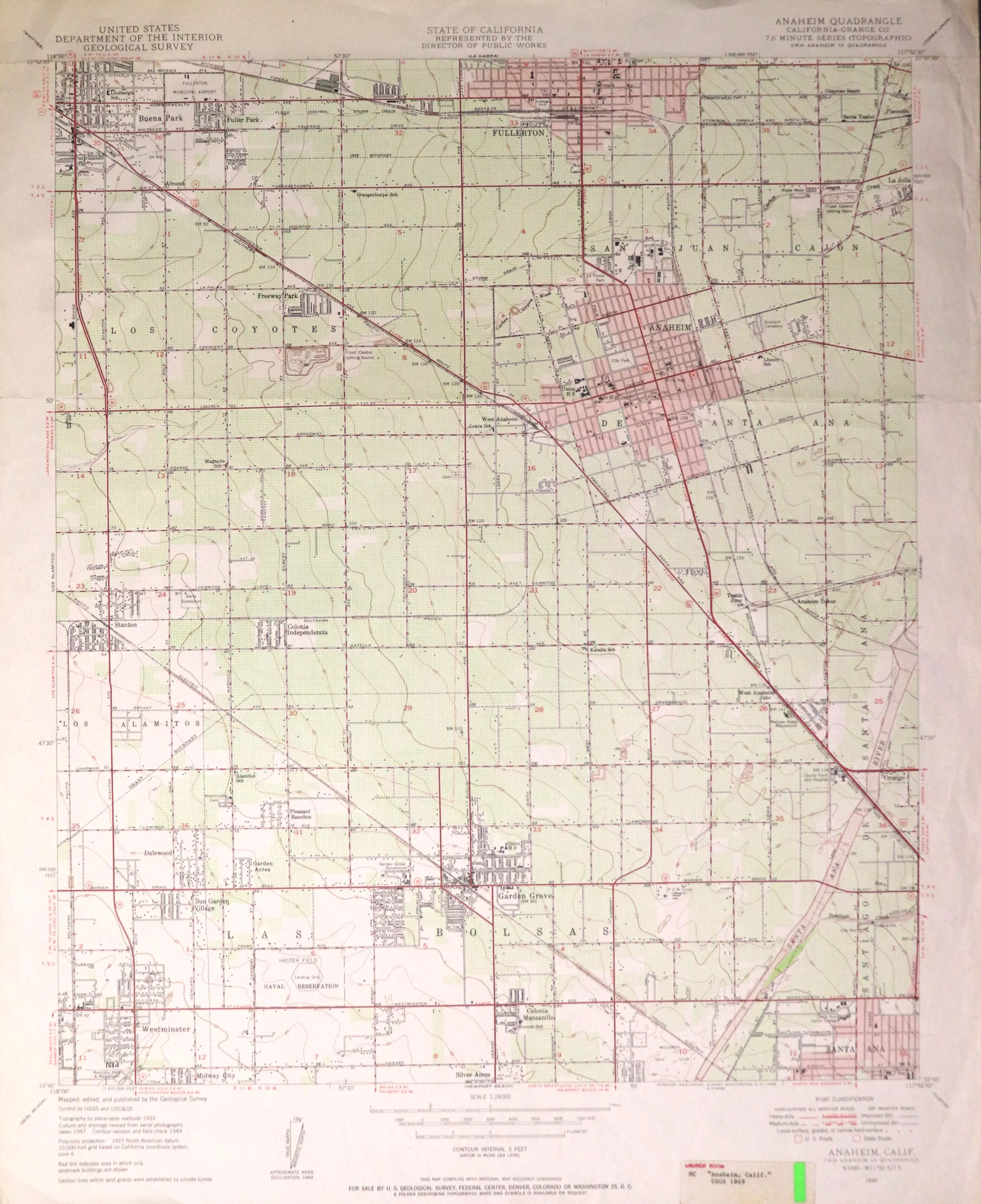
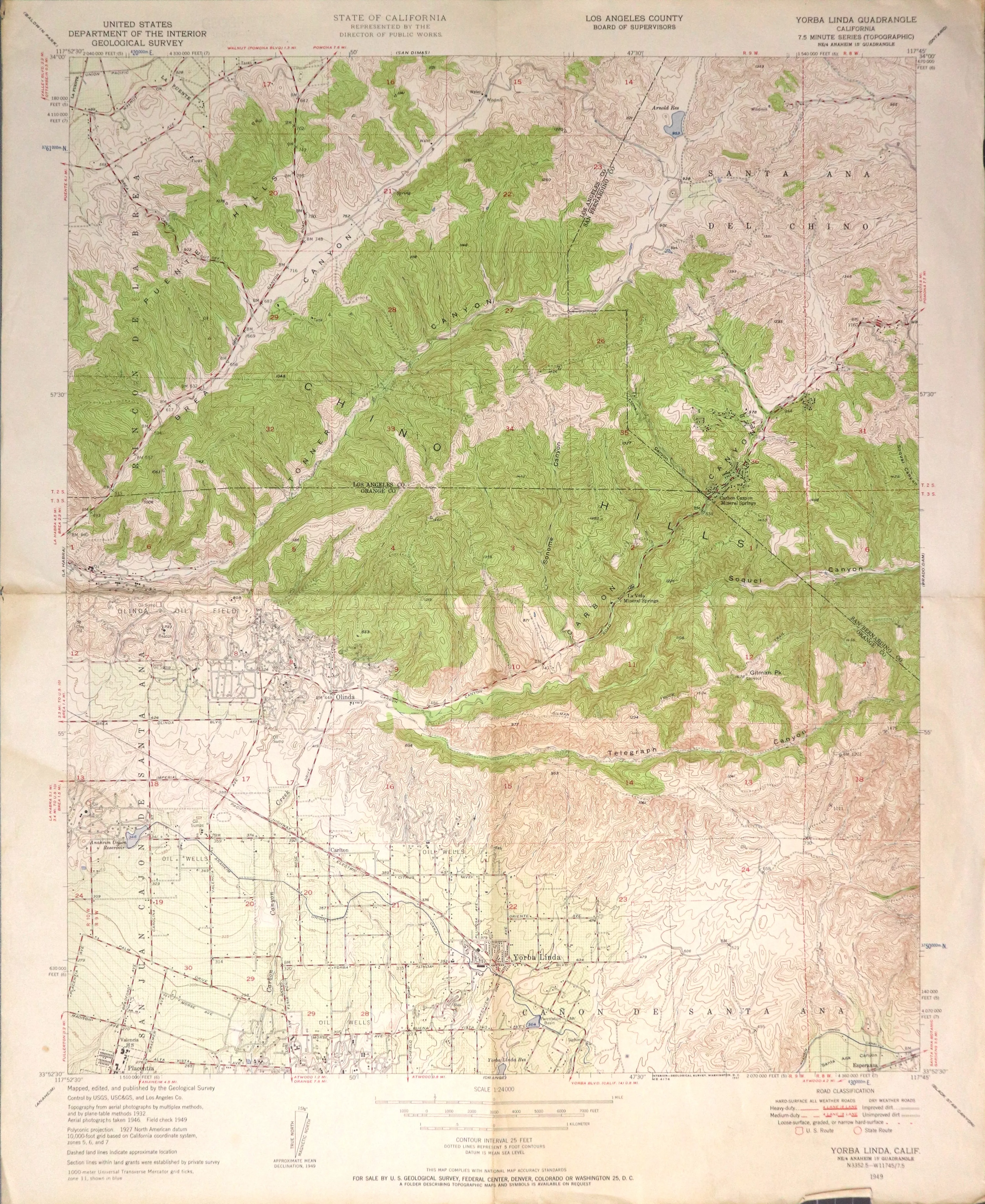
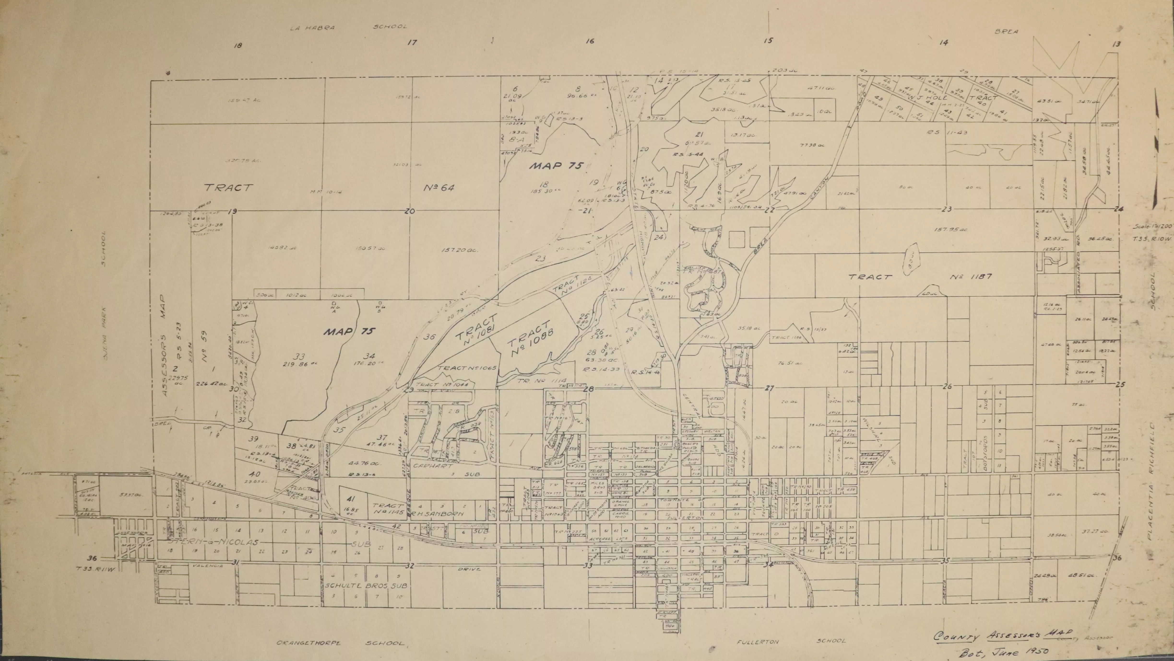
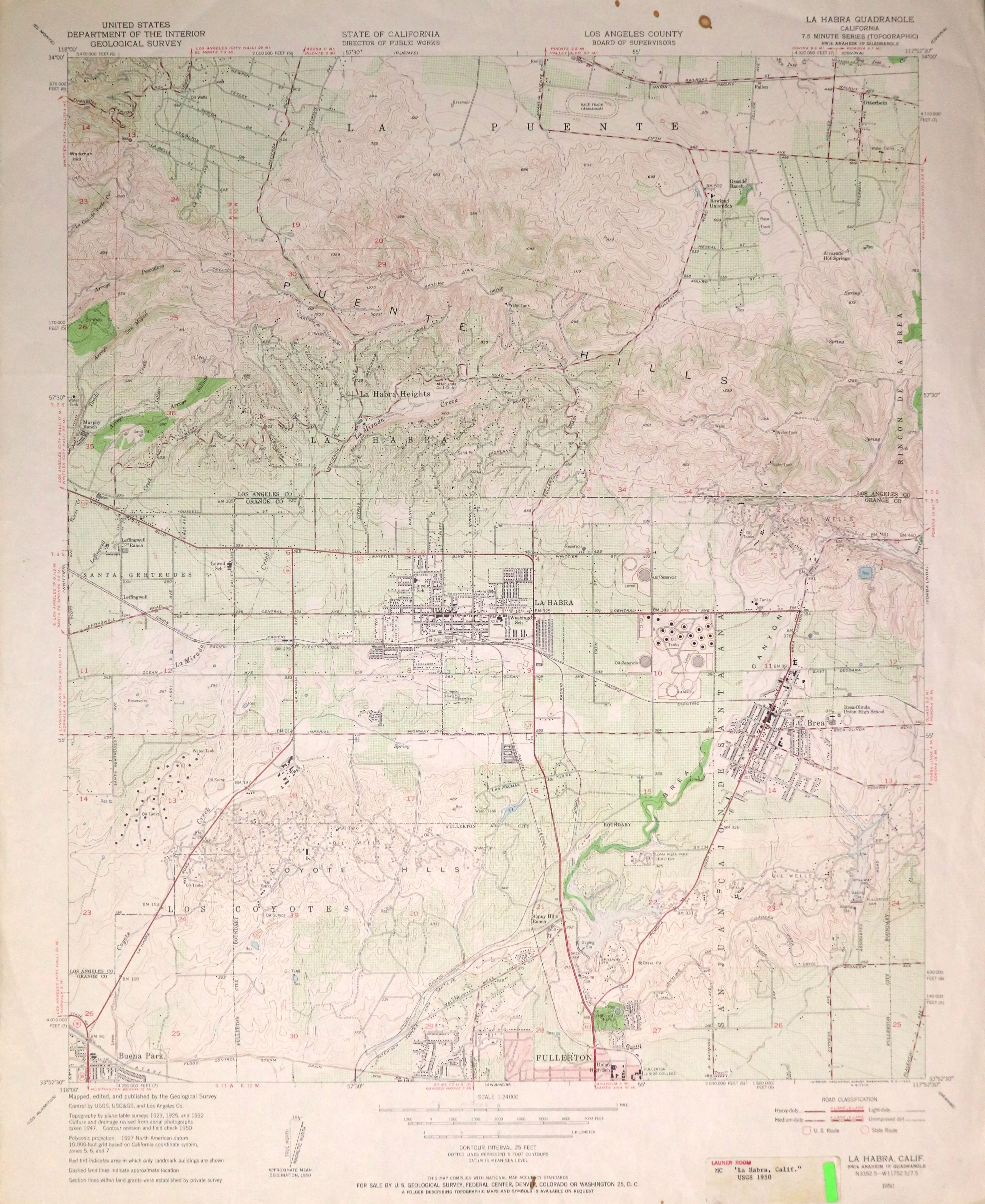
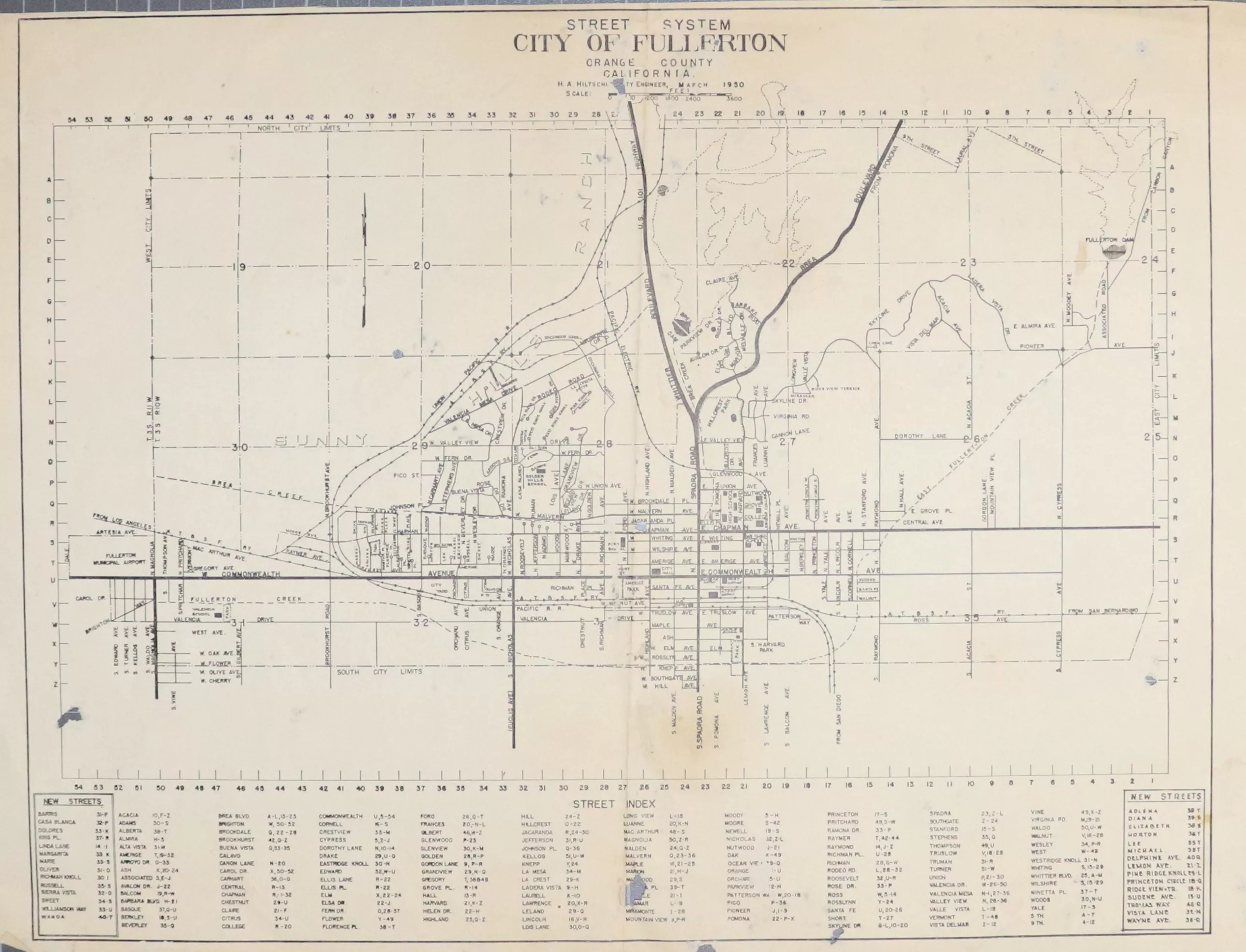
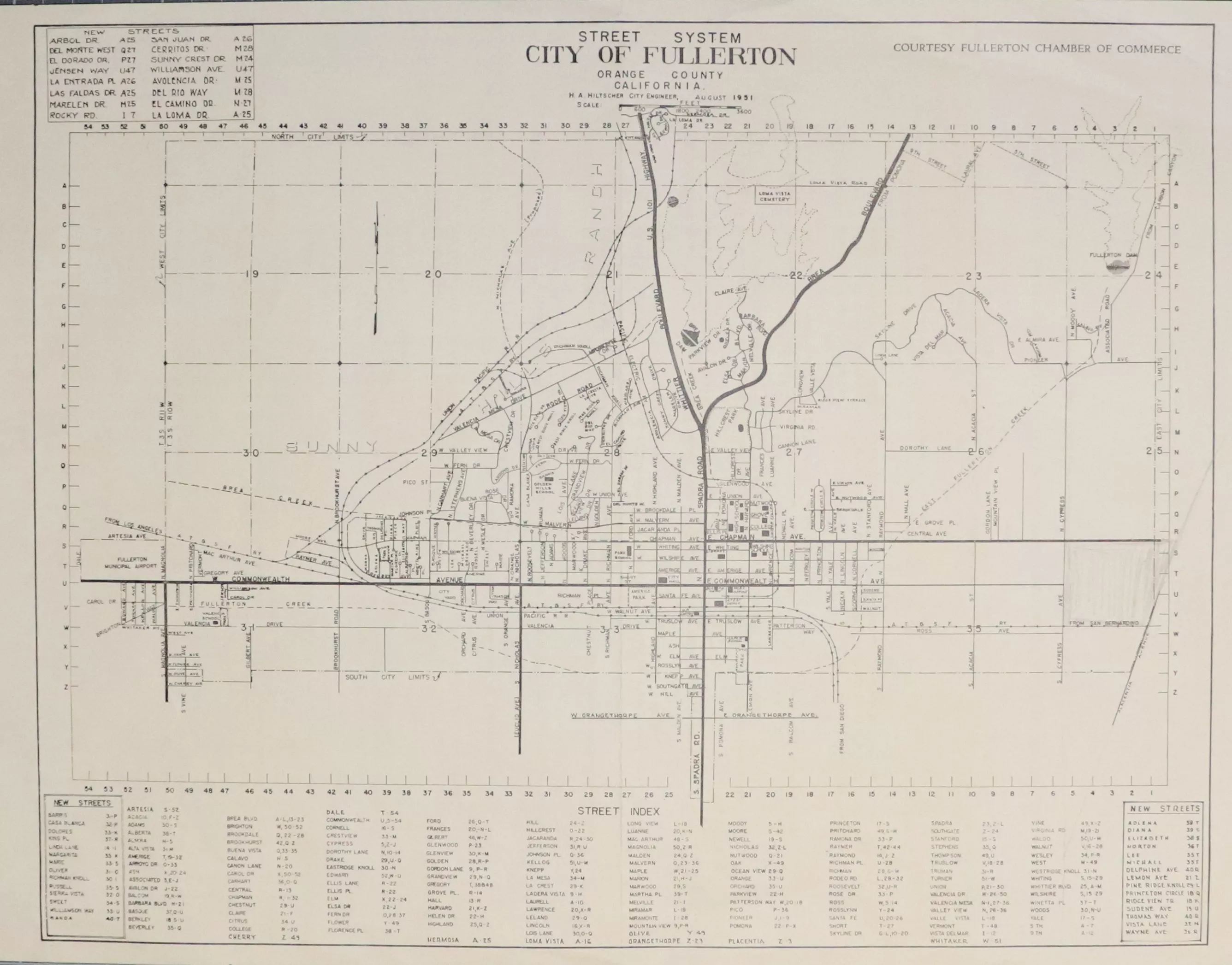
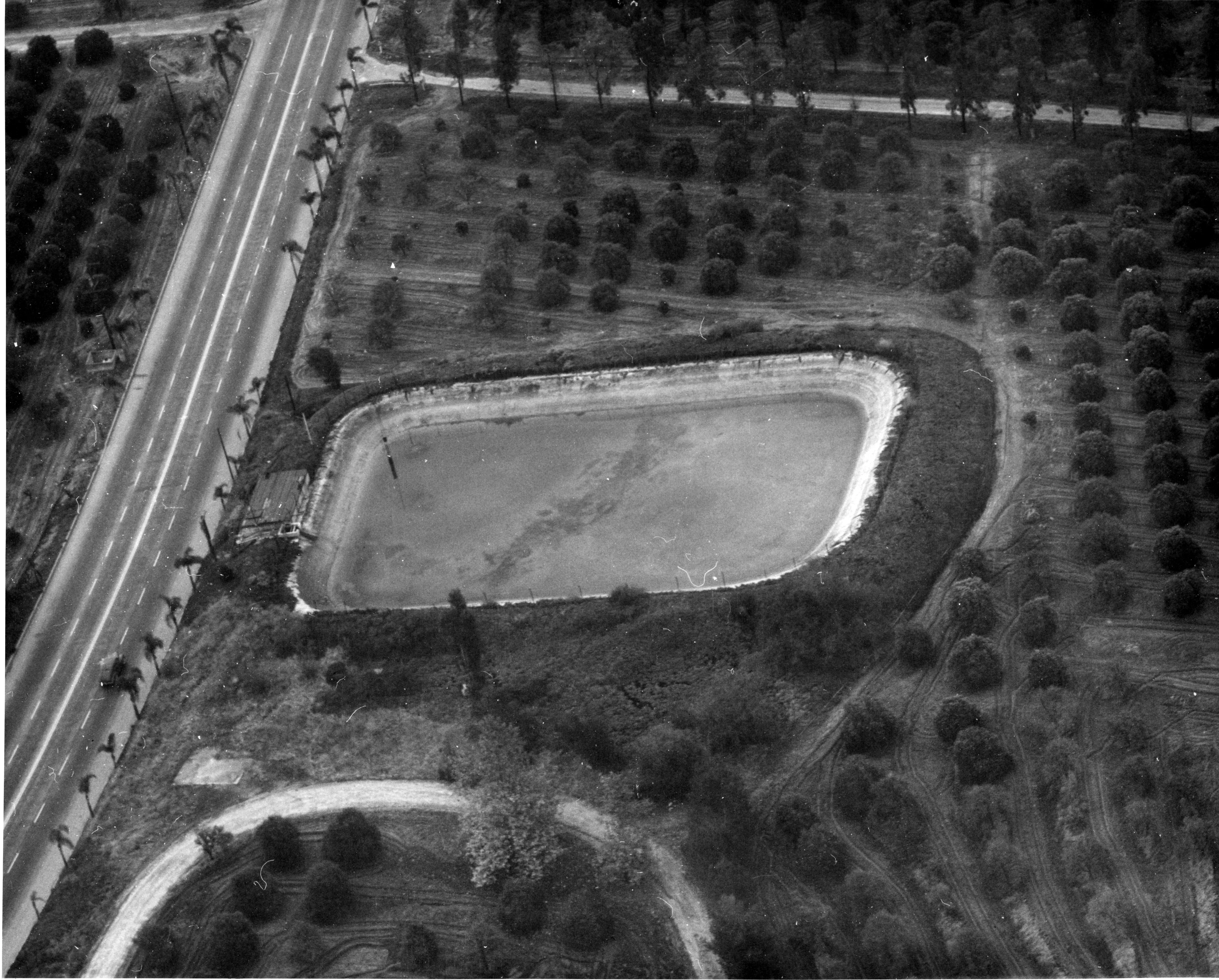
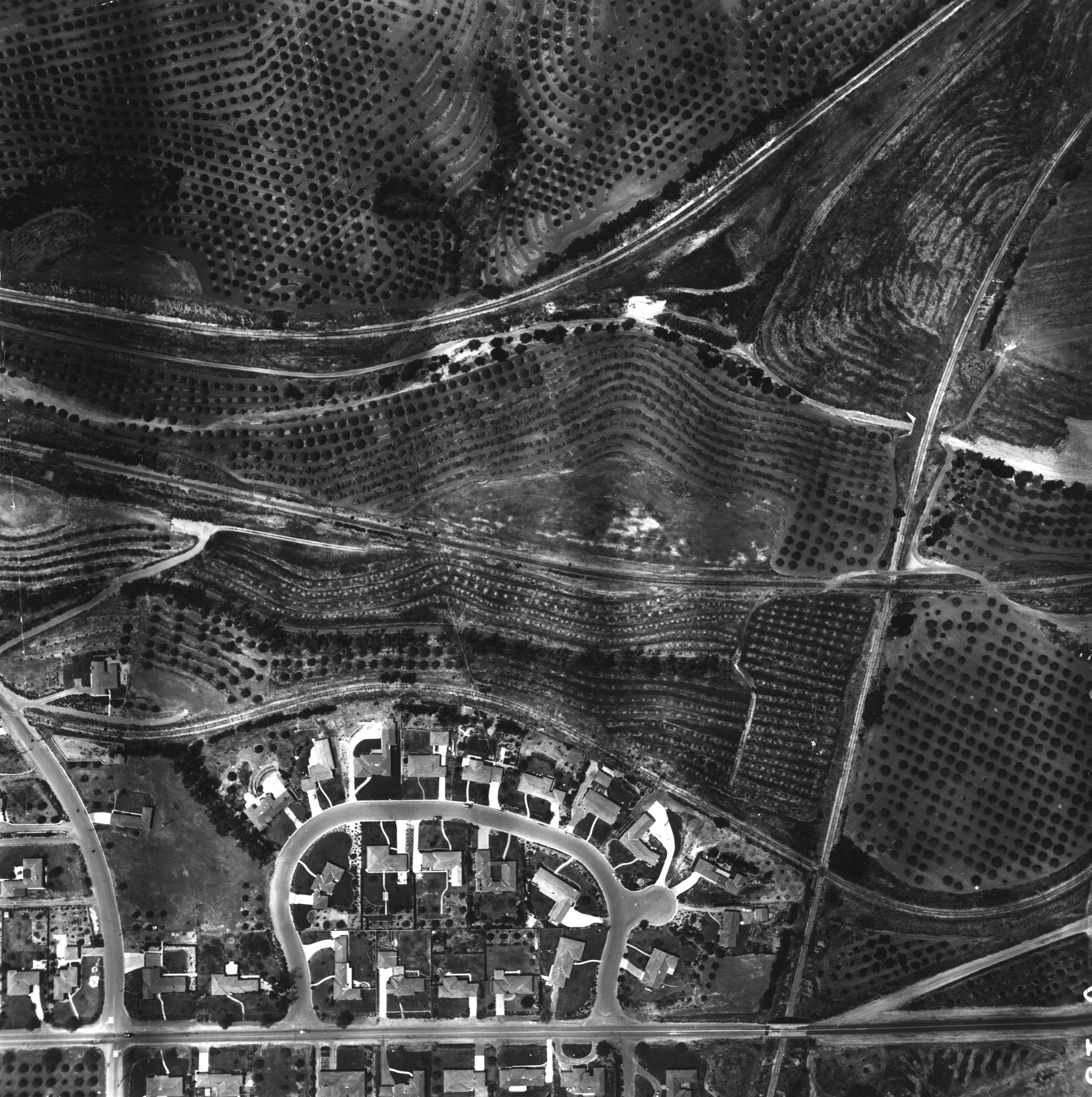
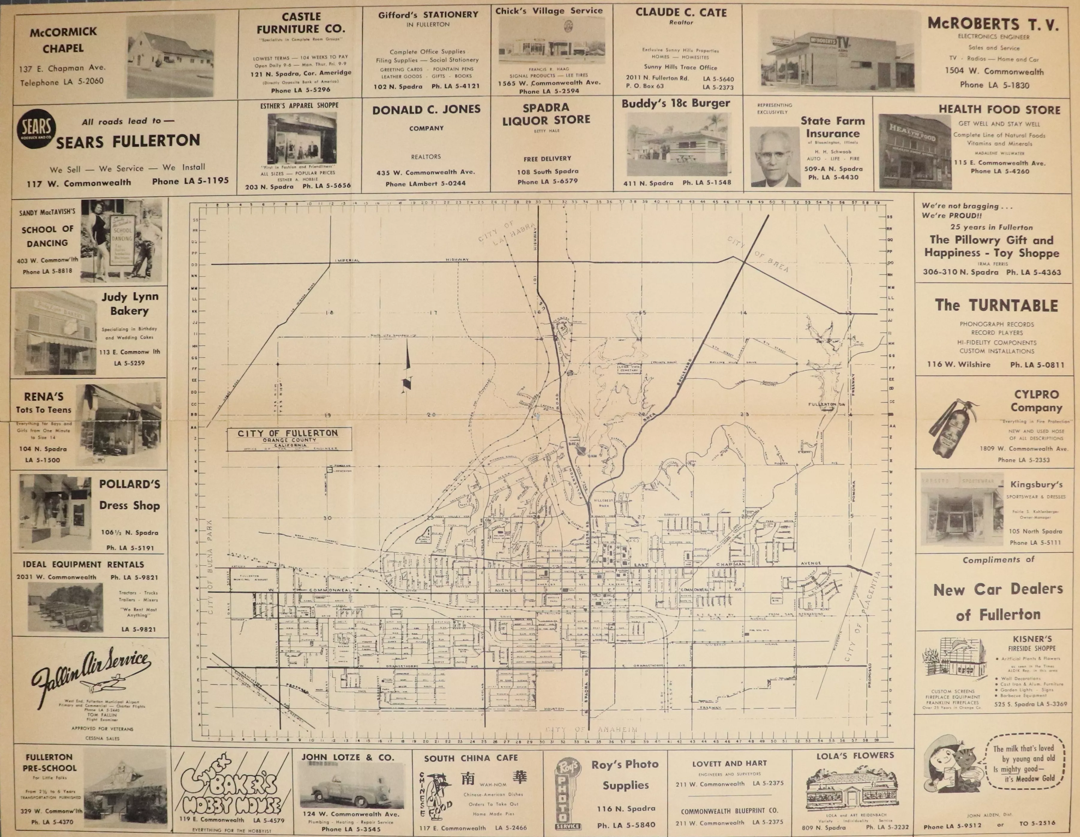
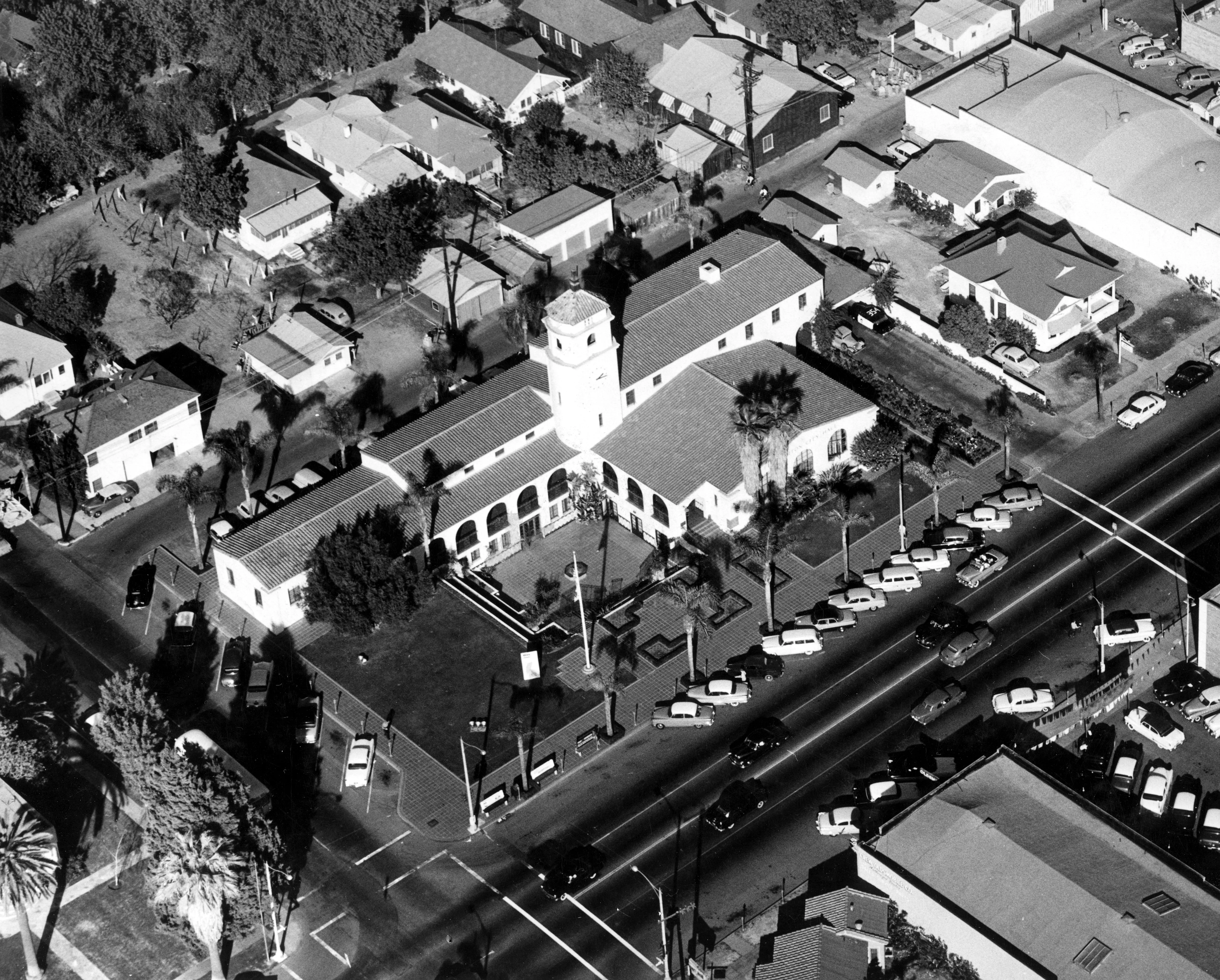
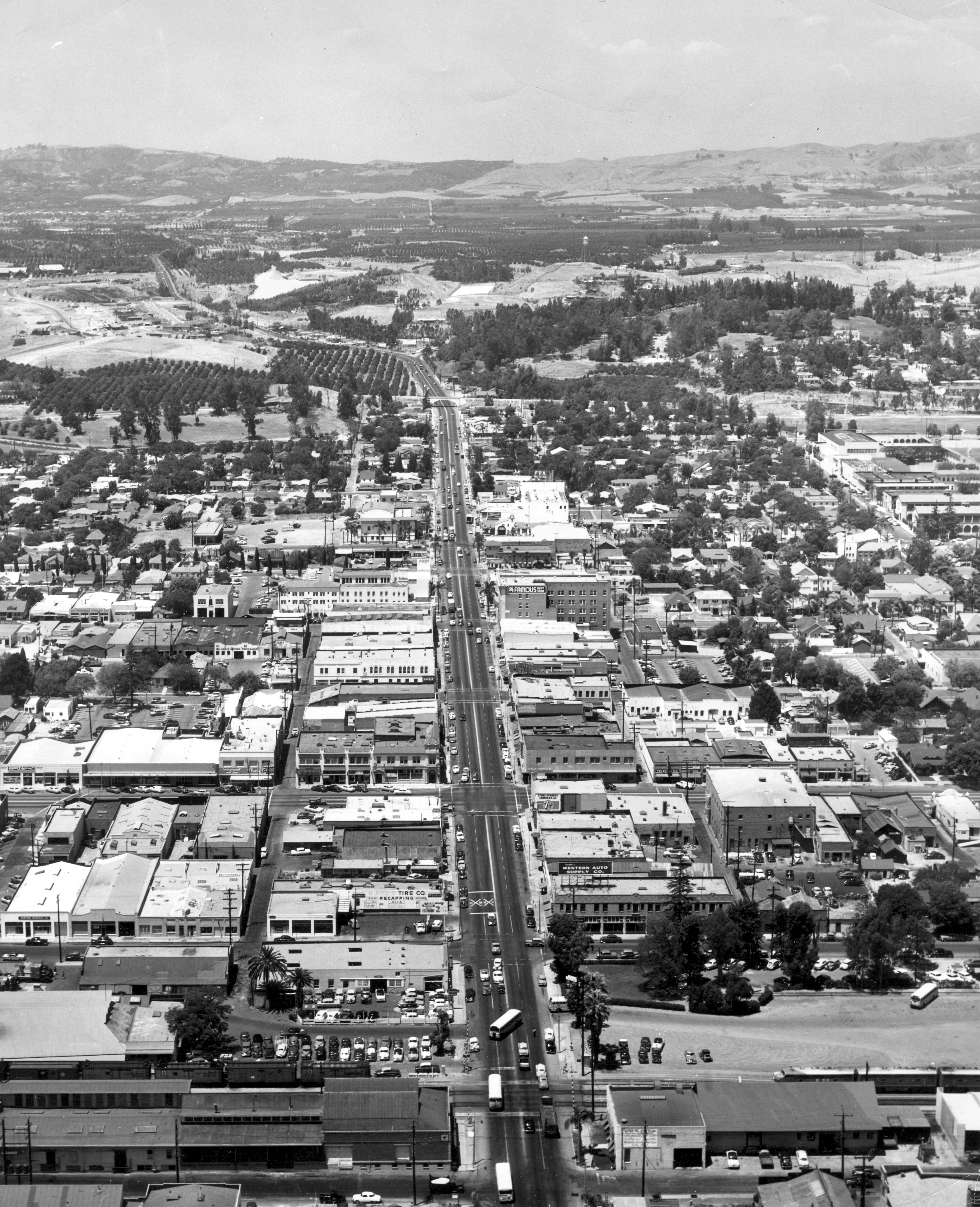
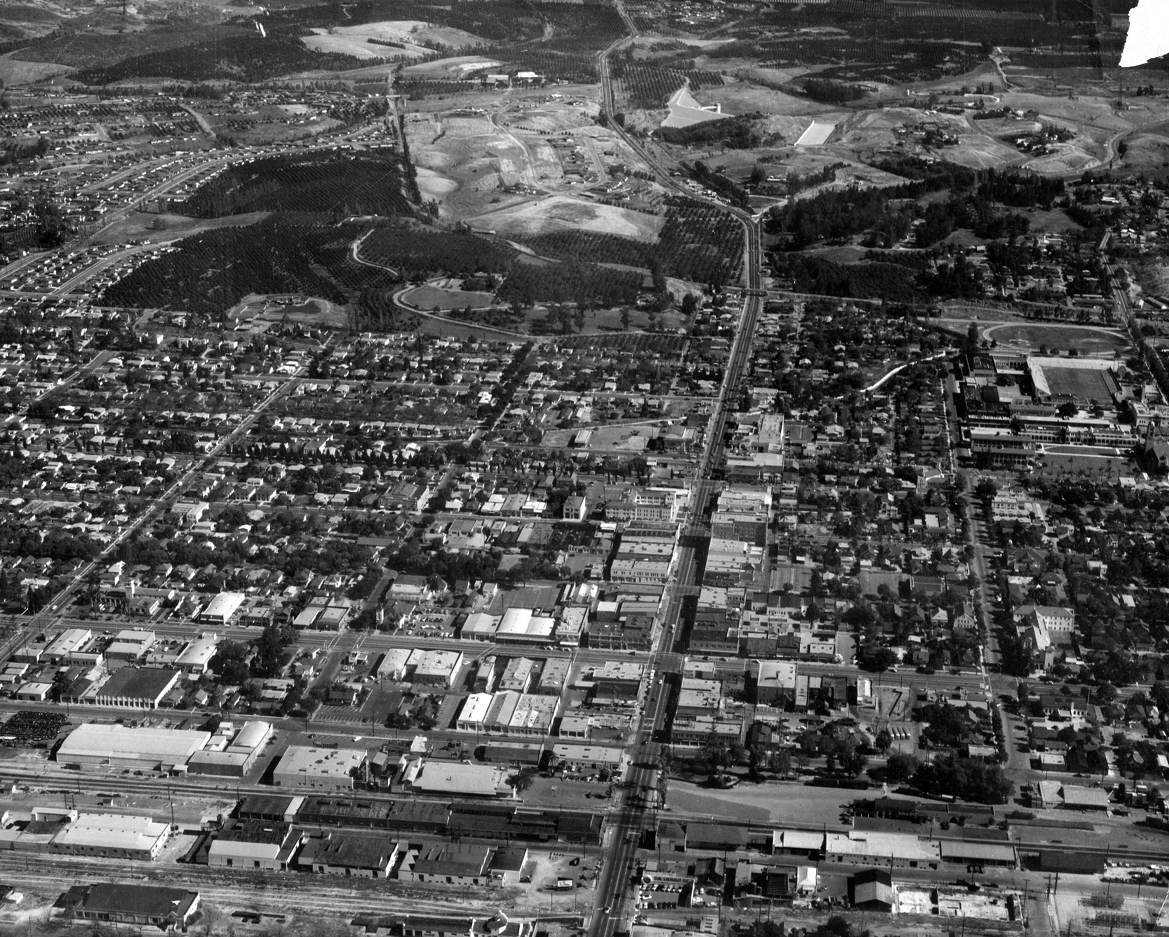
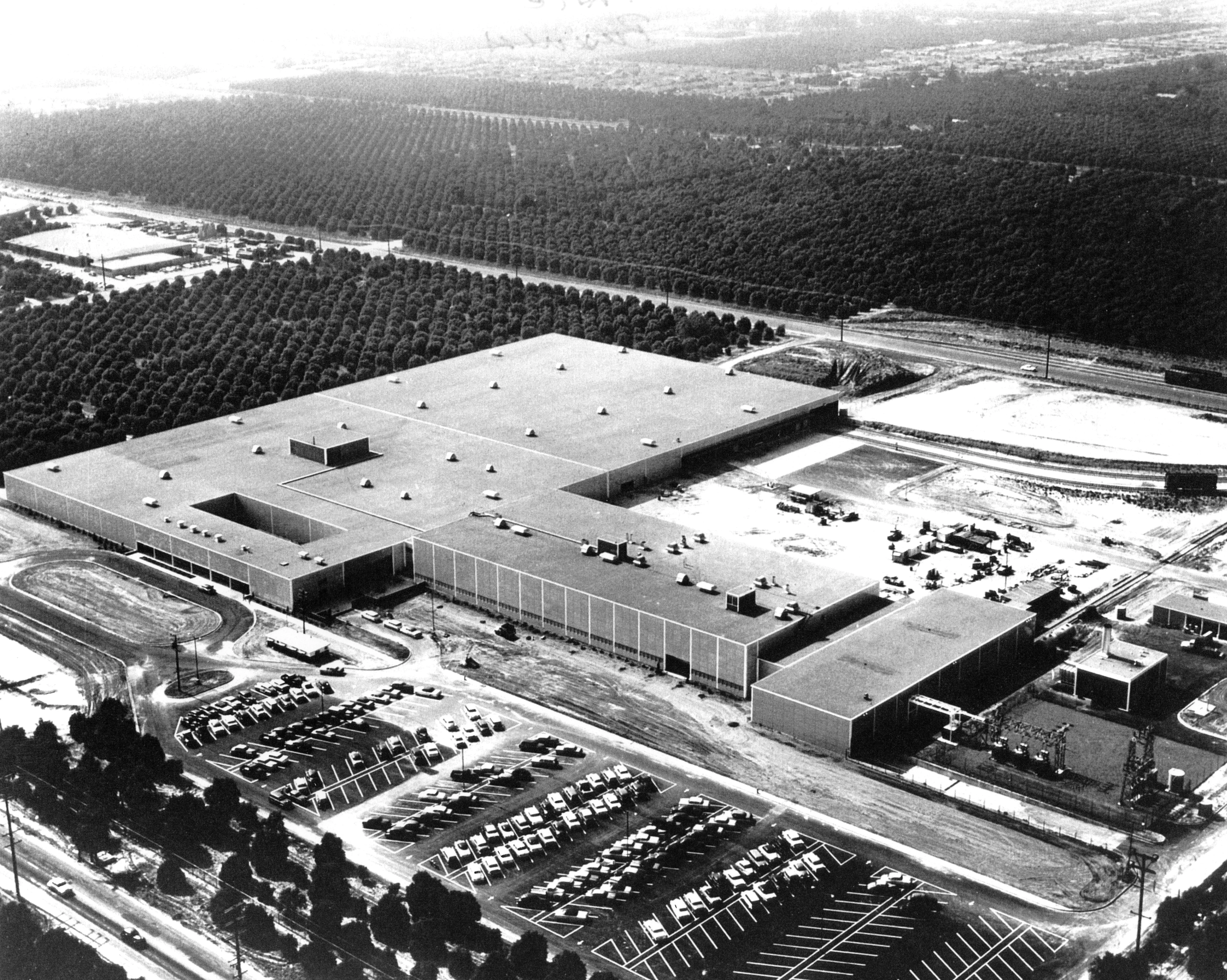
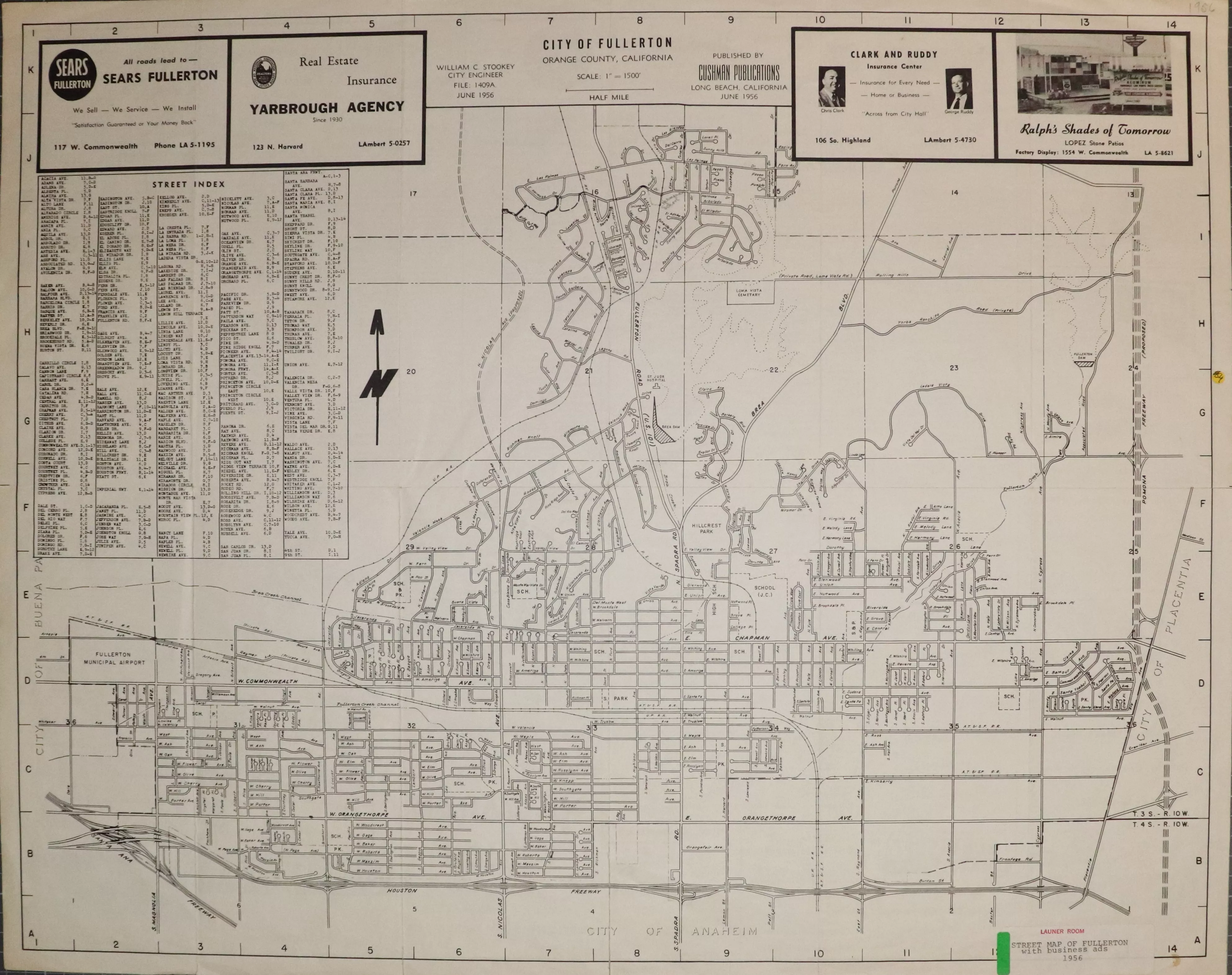
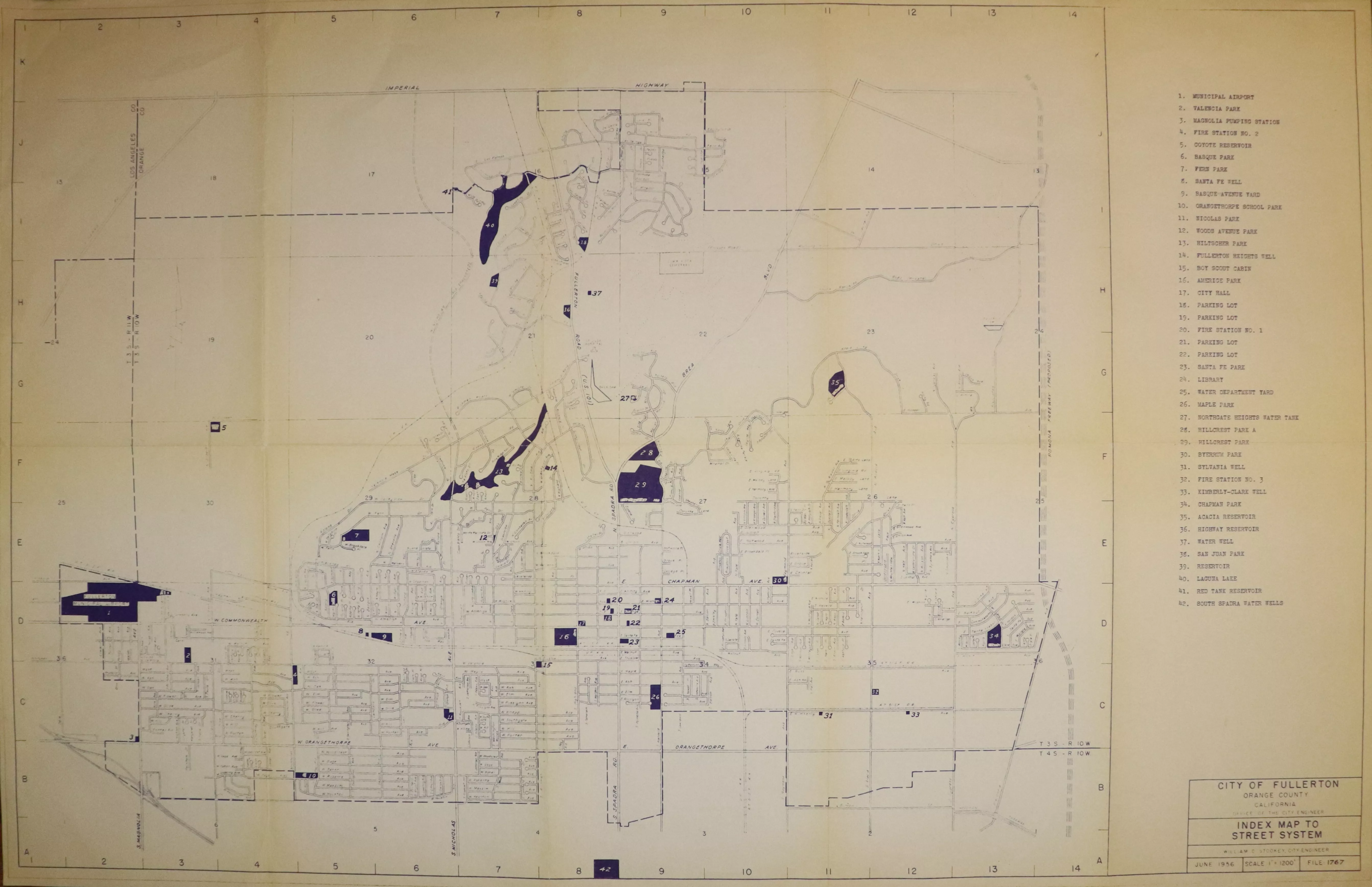
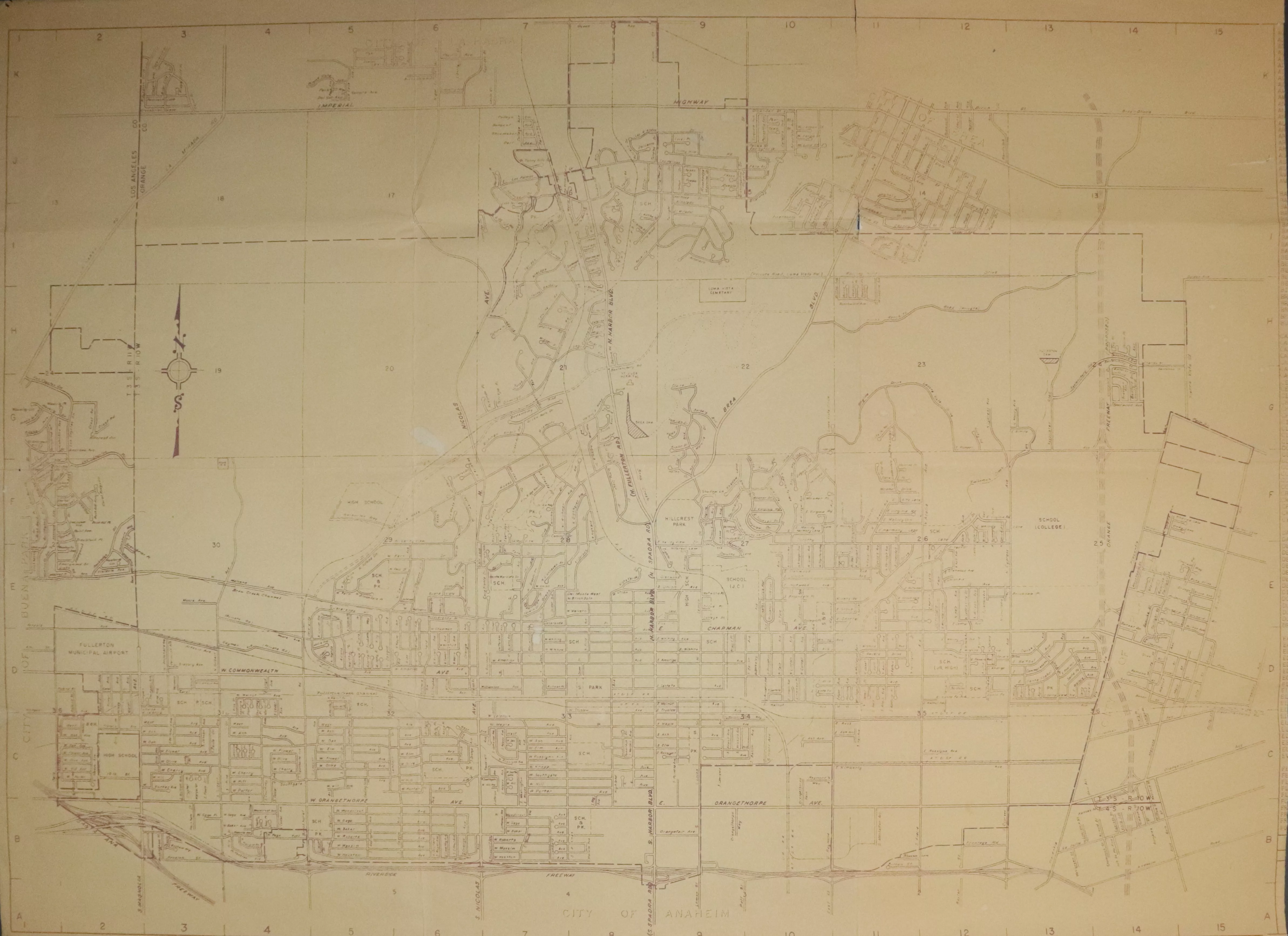
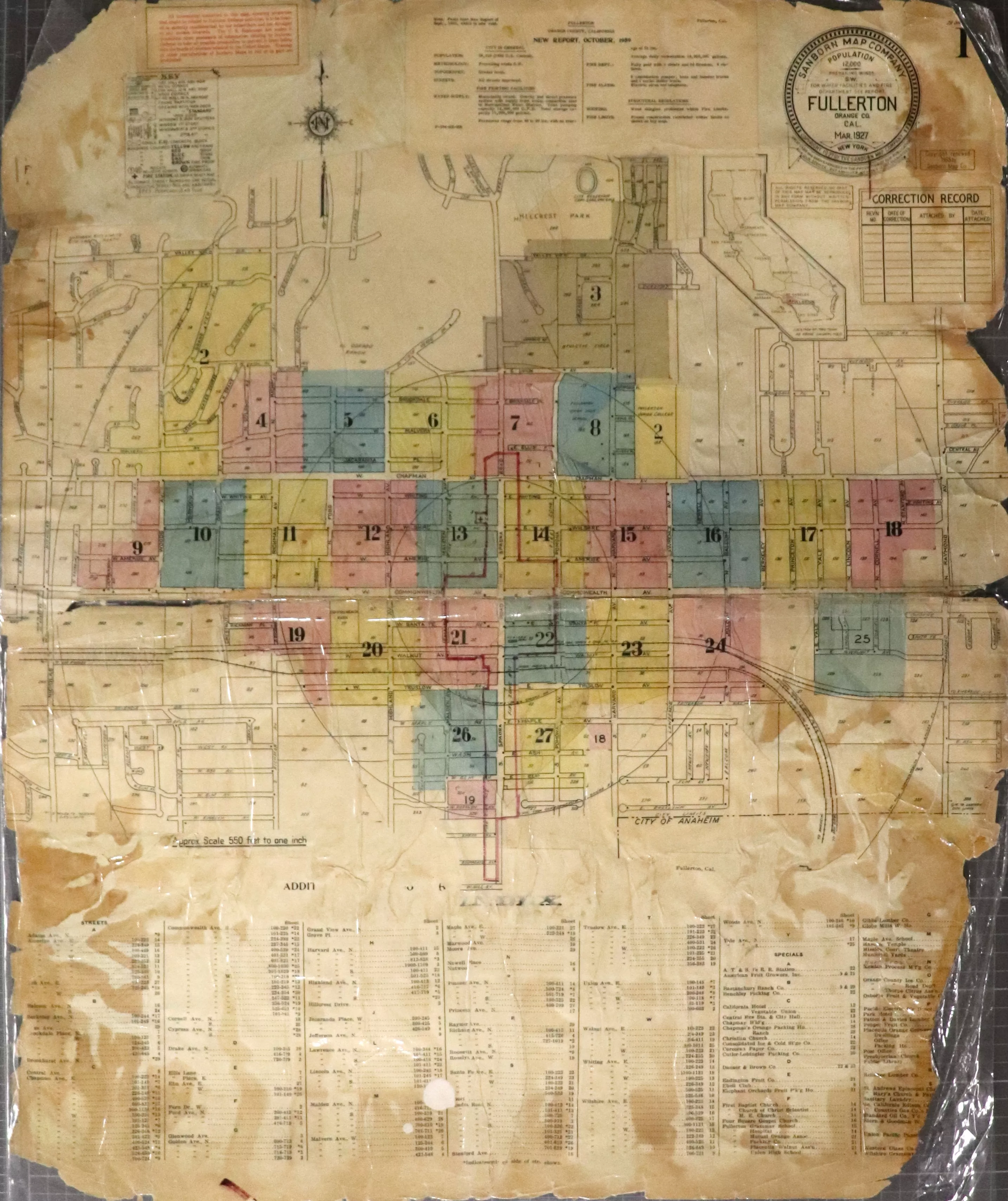
1940 | Street System 1940 | Aerial View: FUHS Campus 1940 | Aerial View: Fullerton College 1941 | Districting Maps Click the image above to view the full map series. 1946 | Aerial View: Airport 1947 | Aerial View: Santa Fe Depot Area 1947 | Aerial View: Union Pacific Depot Area 1947 | Street System 1949 | Anaheim Topographic Map 1949 | Yorba Linda Topographic Map 1950 | County Assessor's Map 1950 | La Habra Topographic Map 1950 | Street System 1951 | Street System 1952 | Aerial View: Bastanchury Ranch Reservoir 1952 | Aerial View: Bastanchury Ranch Area 1952 | Chamber of Commerce Click the image above to view the full map series. 1953 | Aerial View: City Hall 1953 | Aerial View: Downtown Looking North 1953 | Aerial View: Fullerton Looking North 1953 | Street System 1954 | Aerial View: Fullerton College 1955 | Aerial View: Airport 1955 | Aerial Views: Kimberly Clark Construction Click the image above to view the full map series. 1956 | Aerial View: Kimberly Clark 1956 | Chamber of Commerce Click the image above to view the full map series. 1956 | City Facilities 1956 | Street System Click the image above to view the full map series. 1957 | Chamber of Commerce Click the image above to view the full map series. 1958 | Aerial View: Fullerton College 1958 | Chamber of Commerce Click the image above to view the full map series. 1959 | Chamber of Commerce Click the image above to view the full map series. 1959 | Sanborn Maps Click the image above to view the full map series. Additional maps available at the Local History Room. Check out the Local History Room to find more information!